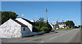
Area Overview for Llanidan Community
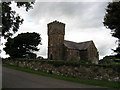
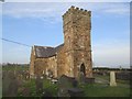
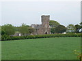
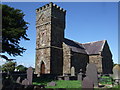
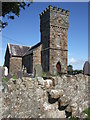
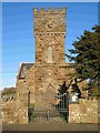
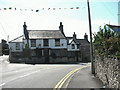
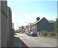
Photos of Llanidan Community


Area Information
Llanidan Community is a distinct civil parish covering an area of 14.2 km² in Wales. This parish offers a specific setting for those considering living in Llanidan Community, defined by its significant portion of protected natural spaces. The environment features designated Areas of Outstanding Natural Beauty and contains protected nature reserves alongside protected woodland. These designations shape the physical character of the land, creating a landscape where planning constraints are actively considered for any future development. While the area prides itself on its natural heritage, you should be aware that these protections limit how many new homes can be built here. This scarcity contributes to a settled feel but means supply is naturally restricted. The parish sits quietly away from the dense urban sprawl often found closer to major cities. Your daily life here would be defined by open skies and historic natural boundaries rather than high-density city living. When looking for homes in Llanidan Community, you are entering a market shaped by geography and environmental law. The small footprint means every hectare carries weight regarding the community's future growth potential. You will find a landscape that prioritises conservation, making it a special place to call your own if you value green spaces over new construction. The people who call Llanidan Community home constitute a very specific demographic profile with a median age of 70 years. This indicates a community dominated by older residents, likely those who have lived there for decades. Most of the population falls into the older age brackets, meaning you should expect a quiet atmosphere with less youthful energy than in town centres. A strong 69% of residents own their homes outright or with a mortgage, suggesting deep-rooted stability within the parish. This high level of home ownership contrasts sharply with rental zones in larger cities where tenants move frequently. Household composition reflects this demographic, with families and empty nesters rather than young professionals forming the core of society. The accommodation type aligns with this ownership figure, showing a stock built for long-term rather than transient living. You will not find the rapid turnover typical of student cities or commuter belts. The community feels like a retirement haven or a destination for those seeking the countryside in their later years. When comparing this to other areas, the lack of young professionals and low diversity in age stands out clearly. If you consider living in Llanidan Community, you are joining a cohort that values permanence and low noise. The social dynamic revolves around established neighbours rather than new arrivals constantly shifting the landscape. Homes in Llanidan Community exist within a market defined by extreme stability and ownership. With 69% of residents owning their homes, the area operates as a classic owner-occupied zone rather than a rental hub. This statistic signals that the housing stock is permanent and likely comprised of older properties occupied by the same families for generations. The low percentage of private rentals suggests you will struggle to find housing without a substantial deposit or significant savings. There are very few buy-to-let landlords actively operating in this small 14.2 km² parish. When buying a property here, you are entering a slow market where sellers are often reluctant to move. The accommodation type data reinforces this picture of settled living, indicating few self-contained units for short-term lets. This is not a place for investors looking for quick turnover or capital growth driven by speculative development. Instead, it is a market for those with secure finances seeking a permanent residence. The constraints on building new homes due to the AONB status further tighten supply, meaning competition for available stock could remain fierce among serious buyers. You will need to conduct thorough due diligence before purchasing, as the resale market may not always be as liquid as in urban centres. The property values here reflect scarcity rather than builder demand. Digital connectivity within Llanidan Community presents a mixed picture for modern living. Your fixed broadband connection falls into the fair category with a quality score of 40 out of 100. This score indicates that online tasks like streaming or video calls may occasionally face interruptions if you rely heavily on fixed-line internet. However, mobile coverage performs significantly better, boasting a score of 77 out of 100. This strong mobile signal makes the area more viable for residents who work remotely via smartphones or tablets rather than desktop setups. You can expect reliable signal for communication and light digital work, but do not expect enterprise-grade speeds for large file downloads or heavy gaming. For someone intending to live in Llanidan Community, this means you must weigh the importance of high-speed broadband against the quality of the mobile network. Commuters without reliable home internet may find the parish limits their ability to work from home efficiently during poor network days. The gap between fixed and mobile scores is notable and worth considering if your home office relies heavily on stationary equipment. While you are not cut off from the digital world, the infrastructure does not match the standards of major urban research parks. Plan your household budget and work habits accordingly to ensure the fair broadband rating does not hinder your daily routine. Environmental and safety assessments for Llanidan Community reveal a landscape governed by natural constraints. The area passes flood risk checks with a low score of 5.56, meaning the land is largely safe from waterlogging and flooding events. This is a reassuring factor for anyone asking about safety concerns regarding weather events. However, planning constraints create a different kind of regulatory watchfulness. The parish lies within an Area of Outstanding Natural Beauty, which carries a warning status and a score of 28.46. This designation means development is heavily scrutinised to protect the visual beauty of the land. You will also find protected nature reserves and protected woodland within the parish boundaries, contributing further warning statuses with scores of 0.31 and 2.21 respectively. While these protections do not threaten personal safety, they strictly control what can be built or altered in the community. The presence of these reserves ensures the green character remains intact but limits expansion. For a family looking at Llanidan Community, the main consideration is navigating these planning rules rather than worrying about crime, as crime data is unavailable for this Welsh area. The environment itself acts as a regulator, maintaining a stable, natural state that prevents chaotic urban growth. What is the main demographic of Llanidan Community?The community has a median age of 70 years, making it predominantly inhabited by older residents. Home ownership stands at 69%, confirming a population of settled homeowners rather than young renters or professionals. How reliable is the internet in Llanidan Community?Mobile coverage is good with a score of 77, but fixed broadband is only fair at a score of 40. Residents should plan for potential internet issues if relying on fixed lines for work from home. Are there any safety risks in the area?Flood risk is low with a score of 5.56. However, planning constraints are high due to the Area of Outstanding Natural Beauty designation and protected woodlands, which restrict new building projects. Is Llanidan Community suitable for investors?With 69% home ownership and AONB constraints limiting new supply, the market is owner-occupied and stable. It is better suited for long-term residents than developers seeking rapid growth.
- Area Type
- Parish
- Area Size
- 14.2 km²
- Population
- Not available
- Population Density
- Not available
Demographics
The people who call Llanidan Community home constitute a very specific demographic profile with a median age of 70 years. This indicates a community dominated by older residents, likely those who have lived there for decades. Most of the population falls into the older age brackets, meaning you should expect a quiet atmosphere with less youthful energy than in town centres. A strong 69% of residents own their homes outright or with a mortgage, suggesting deep-rooted stability within the parish. This high level of home ownership contrasts sharply with rental zones in larger cities where tenants move frequently. Household composition reflects this demographic, with families and empty nesters rather than young professionals forming the core of society. The accommodation type aligns with this ownership figure, showing a stock built for long-term rather than transient living. You will not find the rapid turnover typical of student cities or commuter belts. The community feels like a retirement haven or a destination for those seeking the countryside in their later years. When comparing this to other areas, the lack of young professionals and low diversity in age stands out clearly. If you consider living in Llanidan Community, you are joining a cohort that values permanence and low noise. The social dynamic revolves around established neighbours rather than new arrivals constantly shifting the landscape. Homes in Llanidan Community exist within a market defined by extreme stability and ownership. With 69% of residents owning their homes, the area operates as a classic owner-occupied zone rather than a rental hub. This statistic signals that the housing stock is permanent and likely comprised of older properties occupied by the same families for generations. The low percentage of private rentals suggests you will struggle to find housing without a substantial deposit or significant savings. There are very few buy-to-let landlords actively operating in this small 14.2 km² parish. When buying a property here, you are entering a slow market where sellers are often reluctant to move. The accommodation type data reinforces this picture of settled living, indicating few self-contained units for short-term lets. This is not a place for investors looking for quick turnover or capital growth driven by speculative development. Instead, it is a market for those with secure finances seeking a permanent residence. The constraints on building new homes due to the AONB status further tighten supply, meaning competition for available stock could remain fierce among serious buyers. You will need to conduct thorough due diligence before purchasing, as the resale market may not always be as liquid as in urban centres. The property values here reflect scarcity rather than builder demand. Digital connectivity within Llanidan Community presents a mixed picture for modern living. Your fixed broadband connection falls into the fair category with a quality score of 40 out of 100. This score indicates that online tasks like streaming or video calls may occasionally face interruptions if you rely heavily on fixed-line internet. However, mobile coverage performs significantly better, boasting a score of 77 out of 100. This strong mobile signal makes the area more viable for residents who work remotely via smartphones or tablets rather than desktop setups. You can expect reliable signal for communication and light digital work, but do not expect enterprise-grade speeds for large file downloads or heavy gaming. For someone intending to live in Llanidan Community, this means you must weigh the importance of high-speed broadband against the quality of the mobile network. Commuters without reliable home internet may find the parish limits their ability to work from home efficiently during poor network days. The gap between fixed and mobile scores is notable and worth considering if your home office relies heavily on stationary equipment. While you are not cut off from the digital world, the infrastructure does not match the standards of major urban research parks. Plan your household budget and work habits accordingly to ensure the fair broadband rating does not hinder your daily routine. Environmental and safety assessments for Llanidan Community reveal a landscape governed by natural constraints. The area passes flood risk checks with a low score of 5.56, meaning the land is largely safe from waterlogging and flooding events. This is a reassuring factor for anyone asking about safety concerns regarding weather events. However, planning constraints create a different kind of regulatory watchfulness. The parish lies within an Area of Outstanding Natural Beauty, which carries a warning status and a score of 28.46. This designation means development is heavily scrutinised to protect the visual beauty of the land. You will also find protected nature reserves and protected woodland within the parish boundaries, contributing further warning statuses with scores of 0.31 and 2.21 respectively. While these protections do not threaten personal safety, they strictly control what can be built or altered in the community. The presence of these reserves ensures the green character remains intact but limits expansion. For a family looking at Llanidan Community, the main consideration is navigating these planning rules rather than worrying about crime, as crime data is unavailable for this Welsh area. The environment itself acts as a regulator, maintaining a stable, natural state that prevents chaotic urban growth. What is the main demographic of Llanidan Community?The community has a median age of 70 years, making it predominantly inhabited by older residents. Home ownership stands at 69%, confirming a population of settled homeowners rather than young renters or professionals. How reliable is the internet in Llanidan Community?Mobile coverage is good with a score of 77, but fixed broadband is only fair at a score of 40. Residents should plan for potential internet issues if relying on fixed lines for work from home. Are there any safety risks in the area?Flood risk is low with a score of 5.56. However, planning constraints are high due to the Area of Outstanding Natural Beauty designation and protected woodlands, which restrict new building projects. Is Llanidan Community suitable for investors?With 69% home ownership and AONB constraints limiting new supply, the market is owner-occupied and stable. It is better suited for long-term residents than developers seeking rapid growth.
Household Size
Accommodation Type
Tenure
Ethnic Group
Religion
Household Composition
Age
Household Deprivation
NS-SEC
Explore more demographic insights in this area
Go to Demographics tabPlanning
Planning Constraints
- Flood RiskPremium
- Ramsar Wetland SitesPremium
- Area of Outstanding Natural BeautyPremium
- Protected Nature ReservePremium
- Protected WoodlandPremium
- Crime RiskPremium