Area Overview for Llanfair-Mathafarn-Eithaf Community
Photos of Llanfair-Mathafarn-Eithaf Community
Area Information
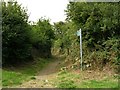
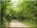
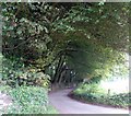
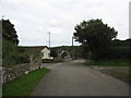
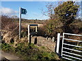
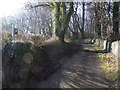
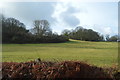
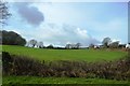
Llanfair-Mathafarn-Eithaf Community stands as a distinct civil parish spanning 15.9 square kilometres in Wales. This rural settlement offers a quiet lifestyle far removed from the pace of major Welsh cities or busy market towns. The landscape is defined by significant natural features that shape daily life. Much of the parish sits within the Anglesey Area of Outstanding Natural Beauty, and the land includes protected woodland and nature reserves. These planning constraints confirm that the area remains largely undeveloped, preserving its open character. There are no paved roads classified as motorways running through the parish, ensuring a tranquil environment. Residents live among scenic vistas rather than dense urban infrastructure. The presence of a Ramsar wetland site further evidences the ecological value of the land. Living in Llanfair-Mathafarn-Eithaf means accepting a rural existence where nature takes precedence over industry. You will find your surroundings are quiet, green, and protected by special designations. The area size indicates a spread-out population rather than a concentrated village centre. Daily life revolves around the natural heritage of the parish. Homes in Llanfair-Mathafarn-Eithaf offer privacy but come with the reality of being embedded in a highly protected landscape.
- Area Type
- Parish
- Area Size
- 15.9 km²
- Population
- Not available
- Population Density
- Not available
Demographics
You will find that the residents of Llanfair-Mathafarn-Eithaf Community have settled for a very specific kind of life. The median age in the parish is 70 years, placing this community squarely in the category of a predominantly older population. Over half of the people living here are likely to be in their seventies or beyond. This demographic profile suggests a quiet, mature neighbourhood where traditional values often hold sway. Home ownership is exceptionally high at 84 per cent, meaning the vast majority of households own their residences outright or with significant mortgage repayment history. Very few residents rent from a landlord, which creates a stable community without the transient nature often found in rental markets. The household composition data indicates that families and older couples form the core of local society. Accommodation types reflect this stability, with permanent housing dominating over temporary or student digs. While specific ethnic group statistics and religious affiliation figures are not detailed in available records, the high rate of home ownership usually correlates with long-term residency and deeper community ties. Living in this parish offers the security of a settled populace where neighbours are likely to be lifelong residents. The age profile and ownership levels paint a picture of a sanctuary for retirees and other older age brackets.
Household Size
Accommodation Type
Tenure
Ethnic Group
Religion
Household Composition
Age
Household Deprivation
NS-SEC
Explore more demographic insights in this area
Go to Demographics tabPlanning
Planning Constraints
- Flood RiskPremium
- Ramsar Wetland SitesPremium
- Area of Outstanding Natural BeautyPremium
- Protected Nature ReservePremium
- Protected WoodlandPremium
- Crime RiskPremium