Area Overview for Llaneugrad Community
Photos of Llaneugrad Community

Area Information
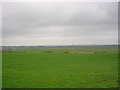
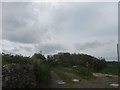
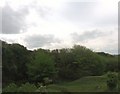
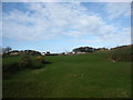
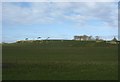
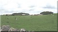
Llaneugrad Community is a civil parish located in Wales covering an area of 11.5 km². The small scale of this settlement creates a defined boundary where daily life moves at a slower pace than in larger towns. You will find that the surrounding landscape significantly influences the rhythm of the neighbourhood. Residents navigate a relatively compact environment where distance to key amenities is minimal by design. Living in Llaneugrad Community means encountering a setting where the built environment sits alongside natural features. The sheer size of the parish suggests that you will not experience the density found in urban centres. Instead, your days will likely involve interacting with a population where long-standing ties often connect neighbours. The specific geography of this 11.5 km² stretch dictates how you reach local services. You must consider the physical layout when planning where your home sits within the parish boundaries. This area functions as a distinct place within the broader Welsh countryside rather than a sprawling expansion of a major town. Your experience here will be shaped by the inherent limits of its size and its designated status as a parish.
- Area Type
- Parish
- Area Size
- 11.5 km²
- Population
- Not available
- Population Density
- Not available
Demographics
The population of Llaneugrad Community displays a pronounced skew towards older demographics. The median age stands at 70 years, indicating that the majority of the retirement cohort resides within these boundaries. Most common age data confirms this focus on the senior demographic. With such a high median age, you should expect a retirement-oriented atmosphere rather than a youthful energy. Households in Llaneugrad Community reflect this stability, with 77% of homes being owner-occupied. This high level of ownership suggests residents have deep roots in the parish and intend to remain for the long term. The household composition data aligns with this static nature, showing a community built on permanence. While specific details on ethnic diversity and religious breakdown are not detailed in available records, the ownership figure speaks volumes about community cohesion. The fact that three in four residents own their homes implies a settled society. This demographic reality means that if you are considering living in Llaneugrad Community, you are entering an environment accustomed to quiet retirement living. The lack of a younger population profile means local events and school activities may be less prominent than in districts attracting families. Your social circle will likely consist of peers who have chosen this specific location for its peaceful nature.
Household Size
Accommodation Type
Tenure
Ethnic Group
Religion
Household Composition
Age
Household Deprivation
NS-SEC
Explore more demographic insights in this area
Go to Demographics tabPlanning
Planning Constraints
- Flood RiskPremium
- Ramsar Wetland SitesPremium
- Area of Outstanding Natural BeautyPremium
- Protected Nature ReservePremium
- Protected WoodlandPremium
- Crime RiskPremium