Area Overview for LL75 8RX
Photos of LL75 8RX


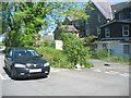

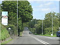
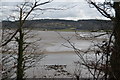

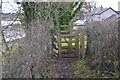
92 photos from this area
Area Information
Key information about the LL75 8RX including its size, population, and administrative classification.
- Area Type
- Postcode
- Area Size
- 34.9 hectares
- Population
- 1337
- Population Density
- 136 people/km²
House Prices in LL75 8RX
13
Properties
£476,111
Average Sold Price
£180,000
Lowest Price
£1,175,000
Highest Price
Showing 13 properties
| Address | Type | Beds | Baths | Last Sale Price | Last Sale Date | |
|---|---|---|---|---|---|---|
| Bryn Llifon, Quay Road, Red Wharf Bay, Pentraeth, LL75 8RX | Bungalow | 4 | 2 | £450,000 | Feb 2021 | |
| Porth Llongdy Uchaf, Quay Road, Red Wharf Bay, Pentraeth, LL75 8RX | Detached | 4 | - | £1,175,000 | Dec 2020 | |
| The Yard, Quay Road, Red Wharf Bay, Pentraeth, LL75 8RX | house | 4 | 2 | £500,000 | Sep 2019 | |
| Elm Grove, Quay Road, Red Wharf Bay, Pentraeth, LL75 8RX | Detached | 3 | - | £375,000 | Sep 2016 | |
| Hen Efail, Quay Road, Red Wharf Bay, Pentraeth, LL75 8RX | Detached | - | - | £500,000 | Dec 2008 | |
| Y Berllan, Quay Road, Red Wharf Bay, Pentraeth, LL75 8RX | Bungalow | - | - | £540,000 | Nov 2007 | |
| Arfryn, Quay Road, Red Wharf Bay, Pentraeth, LL75 8RX | house | - | - | £205,000 | Mar 2006 | |
| Glan Y Don, Quay Road, Red Wharf Bay, Pentraeth, LL75 8RX | Detached | - | - | £360,000 | Apr 2003 | |
| Cei Newydd, Quay Road, Red Wharf Bay, Pentraeth, LL75 8RX | Detached | - | - | £180,000 | Dec 2000 | |
| Laneside, Quay Road, Red Wharf Bay, Pentraeth, LL75 8RX | Detached | - | - | - | - |
Page 1 of 2
Energy Efficiency in LL75 8RX
Amenities
Schools
| Rank | School | Type | Entry gender | Ages |
|---|
Explore more schools in this area
Go to Schools tabDemographics
Household Size
Two person
most common
Accommodation Type
Houses
most common
Tenure
83
majority
Ethnic Group
White
most common
Religion
N/A
most common
Household Composition
N/A
most common
Age
47
median
Elderly (65+ years)
most common
Household Deprivation
N/A
with no deprivation
NS-SEC
34
in Lower managerial occupations
Explore more demographic insights in this area
Go to Demographics tabPlanning
Planning Constraints
- Flood RiskPremium
- Ramsar Wetland SitesPremium
- Area of Outstanding Natural BeautyPremium
- Protected Nature ReservePremium
- Protected WoodlandPremium
- Crime RiskPremium