Area Overview for LL75 8HQ
Photos of LL75 8HQ
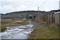
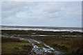
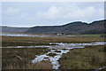
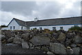
35 photos from this area
Area Information
Key information about the LL75 8HQ including its size, population, and administrative classification.
- Area Type
- Postcode
- Area Size
- 1.3 hectares
- Population
- 1787
- Population Density
- 58 people/km²
House Prices in LL75 8HQ
15
Properties
£117,369
Average Sold Price
£45,000
Lowest Price
£255,200
Highest Price
Showing 15 properties
| Address | Type | Beds | Baths | Last Sale Price | Last Sale Date | |
|---|---|---|---|---|---|---|
| 1 Parc Clai Coediog, Pentraeth, LL75 8HQ | Bungalow | - | - | £255,200 | Dec 2022 | |
| 7 Parc Clai Coediog, Pentraeth, LL75 8HQ | Bungalow | - | - | £170,500 | Jun 2022 | |
| 8 Parc Clai Coediog, Pentraeth, LL75 8HQ | Bungalow | - | - | £167,500 | Mar 2021 | |
| 11 Parc Clai Coediog, Pentraeth, LL75 8HQ | Detached | - | - | £122,000 | Dec 2003 | |
| 5 Parc Clai Coediog, Pentraeth, LL75 8HQ | Bungalow | 3 | 1 | £60,000 | Apr 2001 | |
| 4 Parc Clai Coediog, Pentraeth, LL75 8HQ | Bungalow | - | - | £64,000 | Feb 2001 | |
| 10 Parc Clai Coediog, Pentraeth, LL75 8HQ | Detached | - | - | £54,750 | Nov 1999 | |
| 2 Parc Clai Coediog, Pentraeth, LL75 8HQ | Detached | - | - | £45,000 | Dec 1998 | |
| Bryn Y Mor, 13 Parc Clai Coediog, Pentraeth, LL75 8HQ | Bungalow | 3 | 1 | - | - | |
| Awel Y Mor, 9 Parc Clai Coediog, Pentraeth, LL75 8HQ | Bungalow | 2 | - | - | - |
Page 1 of 2
Energy Efficiency in LL75 8HQ
Amenities
Schools
| Rank | School | Type | Entry gender | Ages |
|---|
Explore more schools in this area
Go to Schools tabDemographics
Household Size
Two person
most common
Accommodation Type
Houses
most common
Tenure
73
majority
Ethnic Group
White
most common
Religion
N/A
most common
Household Composition
N/A
most common
Age
47
median
Adults (30-64 years)
most common
Household Deprivation
N/A
with no deprivation
NS-SEC
35
in Lower managerial occupations
Explore more demographic insights in this area
Go to Demographics tabPlanning
Planning Constraints
- Flood RiskPremium
- Ramsar Wetland SitesPremium
- Area of Outstanding Natural BeautyPremium
- Protected Nature ReservePremium
- Protected WoodlandPremium
- Crime RiskPremium