Area Overview for LL69 9UF
Photos of LL69 9UF
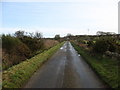
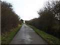
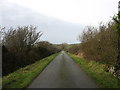
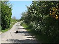
51 photos from this area
Area Information
Key information about the LL69 9UF including its size, population, and administrative classification.
- Area Type
- Postcode
- Area Size
- 58.8 hectares
- Population
- 2312
- Population Density
- 50 people/km²
House Prices in LL69 9UF
7
Properties
£300,475
Average Sold Price
£299,950
Lowest Price
£301,000
Highest Price
Showing 7 properties
| Address | Type | Beds | Baths | Last Sale Price | Last Sale Date | |
|---|---|---|---|---|---|---|
| Ty Popty, Road From Junction At Pensarn Farm To Crossroads At Tyn Lon, Penysarn, LL69 9UF | Detached | 4 | 2 | £299,950 | Jan 2021 | |
| Tyn Y Lon, Road From Junction At Pensarn Farm To Crossroads At Tyn Lon, Penysarn, LL69 9UF | house | - | - | £301,000 | Sep 2016 | |
| Caer Gors, 0 , Penysarn, LL69 9UF | Detached | 5 | 2 | - | - | |
| Nant Newydd, Road From Junction At Pensarn Farm To Crossroads At Tyn Lon, Penysarn, LL69 9UF | Detached | - | - | - | - | |
| Nant Bach, Road From Junction At Pensarn Farm To Crossroads At Tyn Lon, Penysarn, LL69 9UF | Detached | - | - | - | - | |
| Pendref, Road From Junction At Pensarn Farm To Crossroads At Tyn Lon, Penysarn, LL69 9UF | Detached | - | - | - | - | |
| Nant Isaf, Road From Junction At Pensarn Farm To Crossroads At Tyn Lon, Penysarn, LL69 9UF | Bungalow | - | - | - | - |
Energy Efficiency in LL69 9UF
Amenities
Schools
| Rank | School | Type | Entry gender | Ages |
|---|
Explore more schools in this area
Go to Schools tabDemographics
Household Size
Two person
most common
Accommodation Type
Houses
most common
Tenure
75
majority
Ethnic Group
White
most common
Religion
N/A
most common
Household Composition
N/A
most common
Age
47
median
Adults (30-64 years)
most common
Household Deprivation
N/A
with no deprivation
NS-SEC
34
in Lower managerial occupations
Explore more demographic insights in this area
Go to Demographics tabPlanning
Planning Constraints
- Flood RiskPremium
- Ramsar Wetland SitesPremium
- Area of Outstanding Natural BeautyPremium
- Protected Nature ReservePremium
- Protected WoodlandPremium
- Crime RiskPremium