Area Overview for LL67 0DS
Photos of LL67 0DS


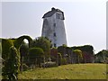
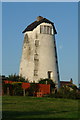
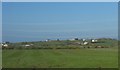
11 photos from this area
Area Information
Key information about the LL67 0DS including its size, population, and administrative classification.
- Area Type
- Postcode
- Area Size
- 51.7 hectares
- Population
- 1177
- Population Density
- 86 people/km²
House Prices in LL67 0DS
25
Properties
£218,153
Average Sold Price
£82,000
Lowest Price
£645,000
Highest Price
Showing 25 properties
| Address | Type | Beds | Baths | Last Sale Price | Last Sale Date | |
|---|---|---|---|---|---|---|
| Gongl Felys, Road From Gorphwysfa To Ffordd Y Felin, Tregele, Cemaes, LL67 0DS | Detached | 3 | - | £355,000 | Nov 2025 | |
| 3 Mill Cottage, 0 , Cemaes Bay, LL67 0DS | Terraced | 3 | 1 | £125,000 | Sep 2025 | |
| Am Byth, Ffordd Y Felin, Cemaes, LL67 0DS | house | - | - | £320,000 | Oct 2023 | |
| Mill Bungalow, Ffordd Y Felin, Cemaes, LL67 0DS | Bungalow | - | - | £130,000 | Jan 2023 | |
| Hafod, Ffordd Y Felin, Cemaes, LL67 0DS | Detached | 6 | - | £230,000 | Sep 2021 | |
| HAFOD COTTAGE, FFORDD Y FELIN, Cemaes, LL67 0DS | Detached | - | - | £230,000 | Sep 2021 | |
| Cefn Helyg Cyll, Ffordd Y Felin, Cemaes, LL67 0DS | house | - | - | £645,000 | Aug 2021 | |
| Hafan Heddwch, Ffordd Y Felin, Cemaes, LL67 0DS | house | - | - | £250,000 | Mar 2021 | |
| 1, Mill Cottage, Ffordd Y Felin, Cemaes, LL67 0DS | house | - | - | £100,000 | Aug 2018 | |
| 2, Mill Cottage, Ffordd Y Felin, Cemaes, LL67 0DS | house | - | - | £82,000 | Dec 2017 |
Page 1 of 3
Energy Efficiency in LL67 0DS
Amenities
Schools
| Rank | School | Type | Entry gender | Ages |
|---|
Explore more schools in this area
Go to Schools tabDemographics
Household Size
Two person
most common
Accommodation Type
Houses
most common
Tenure
71
majority
Ethnic Group
White
most common
Religion
N/A
most common
Household Composition
N/A
most common
Age
47
median
Adults (30-64 years)
most common
Household Deprivation
N/A
with no deprivation
NS-SEC
30
in Lower managerial occupations
Explore more demographic insights in this area
Go to Demographics tabPlanning
Planning Constraints
- Flood RiskPremium
- Ramsar Wetland SitesPremium
- Area of Outstanding Natural BeautyPremium
- Protected Nature ReservePremium
- Protected WoodlandPremium
- Crime RiskPremium