Area Overview for LL67 0DH
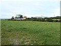
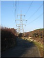
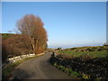
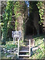
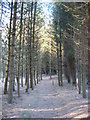
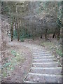
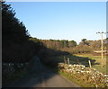
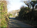
Photos of LL67 0DH
Area Information
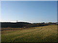
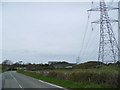
LL67 0DH is a small, tightly knit postcode area in Wales, covering just 1.0 km² and home to 1,177 residents. With a population density of 86 people per square kilometre, it’s a compact community where daily life unfolds in a mix of residential tranquillity and local amenities. The area is defined by its modest scale, offering a quiet alternative to larger towns while still providing access to nearby services. Its residents, predominantly adults aged 30–64, reflect a mature demographic with a strong sense of local identity. The area’s proximity to natural landscapes, including parts of an Area of Outstanding Natural Beauty, hints at a connection to the surrounding environment. For those seeking a low-maintenance lifestyle, LL67 0DH’s small size and limited development suggest a stable, unchanging character. However, the presence of protected woodland within the area introduces planning constraints that buyers should consider. This postcode is ideal for those prioritising space, community cohesion, and a slower pace of life.
- Area Type
- Postcode
- Area Size
- 1.0 km²
- Population
- 1177
- Population Density
- 86 people/km²
LL67 0DH is a largely owner-occupied area, with 71% of properties owned by their residents rather than rented out. The accommodation type is predominantly houses, which is typical for smaller, rural postcodes where land availability limits high-density development. This suggests a market characterised by family homes and long-term ownership rather than a rental-focused environment. The small size of the area—just 1.0 km²—means the housing stock is limited, potentially making it a niche market for buyers seeking properties in a quiet, low-density setting. The presence of protected woodland and an Area of Outstanding Natural Beauty may influence planning restrictions, which could affect future development or renovations. For buyers, this means the area is unlikely to see rapid growth or speculative investment, offering instead a stable, established residential environment with a focus on privacy and natural surroundings.
House Prices in LL67 0DH
Showing 1 properties
| Address | Type | Beds | Baths | Last Sale Price | Last Sale Date | |
|---|---|---|---|---|---|---|
| Wastewater Treatment Works, Wylfa Power Station, Road From A 5025 Near Pen Lon Northwards Past Lodge To Car Park Near Wylfa Power, Cemaes, LL67 0DH | Industrial | - | - | - | - |
Energy Efficiency in LL67 0DH
Residents of LL67 0DH have access to three retail outlets within practical reach: Morrisons Daily, Spar, and Co-op Amlwch. These shops provide basic grocery and convenience services, supporting daily needs without requiring long journeys. Beyond retail, the area’s proximity to protected woodland and an Area of Outstanding Natural Beauty suggests opportunities for outdoor activities, though specific parks or leisure facilities are not listed in the data. The small size of the postcode means the community is likely centred around these local amenities, fostering a close-knit environment. While the data does not detail dining or entertainment options, the presence of multiple shops indicates a functional, if modest, lifestyle. The area’s character is defined by its simplicity, with residents relying on nearby services and natural surroundings for recreation.
Amenities
Schools
The nearest school to LL67 0DH is Ysgol Gynradd Cemaes, listed as an ‘other’ type in the data. While no Ofsted rating is provided, the school’s presence suggests some level of educational provision for local families. However, the data does not specify the school’s age range, curriculum, or performance metrics, leaving gaps in understanding its capacity to meet the needs of residents. Given the area’s small population and the absence of additional schools, families may need to look beyond LL67 0DH for secondary or specialist education. The limited school options could be a consideration for prospective buyers with children, particularly if they require specific educational facilities or a broader range of school types.
| Rank | School | Type | Entry gender | Ages |
|---|
Explore more schools in this area
Go to Schools tabDemographics
The population of LL67 0DH is predominantly adults aged 30–64, with a median age of 47. This suggests a community of established professionals and families, many of whom may have lived in the area for years. Home ownership is high at 71%, indicating a strong presence of long-term residents rather than transient renters. The accommodation type is primarily houses, which aligns with the area’s low density and residential character. The predominant ethnic group is White, reflecting the broader demographic trends in rural Wales. While no specific deprivation data is provided, the high home ownership rate and stable age profile suggest a community with relatively consistent economic conditions. The absence of detailed diversity statistics means the area’s social composition remains largely unexplored in the data, but the figures available point to a settled, middle-aged population with a focus on residential stability.
Household Size
Accommodation Type
Tenure
Ethnic Group
Religion
Household Composition
Age
Household Deprivation
NS-SEC
Explore more demographic insights in this area
Go to Demographics tabPlanning
Planning Constraints
- Flood RiskPremium
- Ramsar Wetland SitesPremium
- Area of Outstanding Natural BeautyPremium
- Protected Nature ReservePremium
- Protected WoodlandPremium
- Crime RiskPremium