Area Overview for LL65 4SN
Photos of LL65 4SN
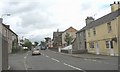
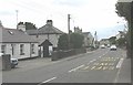
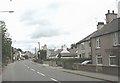
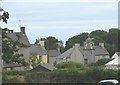
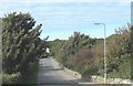
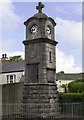
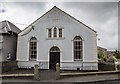
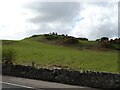
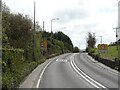
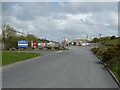
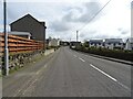
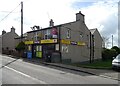
43 photos from this area
Area Information
Key information about the LL65 4SN including its size, population, and administrative classification.
- Area Type
- Postcode
- Area Size
- 1.9 hectares
- Population
- 1871
- Population Density
- 79 people/km²
House Prices in LL65 4SN
7
Properties
£212,500
Average Sold Price
£145,000
Lowest Price
£280,000
Highest Price
Showing 7 properties
| Address | Type | Beds | Baths | Last Sale Price | Last Sale Date | |
|---|---|---|---|---|---|---|
| Llain Y Groes, Lon Pentracha, Gwalchmai, Holyhead, LL65 4SN | Bungalow | 5 | 2 | £280,000 | Oct 2014 | |
| Dafarn Groes, Lon Pentracha, Gwalchmai, Holyhead, LL65 4SN | Bungalow | - | - | £145,000 | Mar 2012 | |
| Pen Parc, Lon Pentracha, Gwalchmai, Holyhead, LL65 4SN | Bungalow | 3 | 2 | - | - | |
| Glydfan, Lon Pentracha, Gwalchmai, Holyhead, LL65 4SN | Bungalow | 3 | - | - | - | |
| Roelen, Lon Pentracha, Gwalchmai, Holyhead, LL65 4SN | Detached | - | - | - | - | |
| Pen Parc Bach, Road From Near Groeslon Past Pen Lon And Hafod Newydd To Junction West Of Glanra, Gwalchmai, Holyhead, LL65 4SN | Detached | - | - | - | - | |
| Celen Allt, Lon Pentracha, Gwalchmai, Holyhead, LL65 4SN | house | - | - | - | - |
Energy Efficiency in LL65 4SN
Amenities
Schools
| Rank | School | Type | Entry gender | Ages |
|---|
Explore more schools in this area
Go to Schools tabDemographics
Household Size
Two person
most common
Accommodation Type
Houses
most common
Tenure
70
majority
Ethnic Group
White
most common
Religion
N/A
most common
Household Composition
N/A
most common
Age
47
median
Adults (30-64 years)
most common
Household Deprivation
N/A
with no deprivation
NS-SEC
28
in Lower managerial occupations
Explore more demographic insights in this area
Go to Demographics tabPlanning
Planning Constraints
- Flood RiskPremium
- Ramsar Wetland SitesPremium
- Area of Outstanding Natural BeautyPremium
- Protected Nature ReservePremium
- Protected WoodlandPremium
- Crime RiskPremium