Area Overview for LL65 3LP
Photos of LL65 3LP
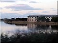
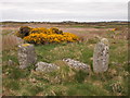
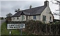
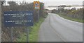
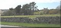
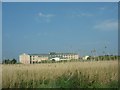
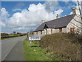
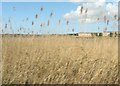
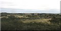
9 photos from this area
Area Information
Key information about the LL65 3LP including its size, population, and administrative classification.
- Area Type
- Postcode
- Area Size
- 3.7 hectares
- Population
- 1356
- Population Density
- 99 people/km²
House Prices in LL65 3LP
27
Properties
£84,381
Average Sold Price
£16,500
Lowest Price
£160,000
Highest Price
Showing 27 properties
| Address | Type | Beds | Baths | Last Sale Price | Last Sale Date | |
|---|---|---|---|---|---|---|
| 49 Minffordd Road, Caergeiliog, Holyhead, LL65 3LP | Semi-detached | 2 | 1 | £142,000 | Feb 2025 | |
| 51 Minffordd Road, Caergeiliog, Holyhead, LL65 3LP | house | - | - | £124,000 | Jun 2022 | |
| 53 Minffordd Road, Caergeiliog, Holyhead, LL65 3LP | Semi-detached | 2 | 1 | £82,500 | Mar 2020 | |
| 82 Minffordd Road, Caergeiliog, Holyhead, LL65 3LP | Semi-detached | 2 | 2 | £99,000 | Aug 2017 | |
| 74 Minffordd Road, Caergeiliog, Holyhead, LL65 3LP | house | - | - | £111,000 | Aug 2008 | |
| 76 Minffordd Road, Caergeiliog, Holyhead, LL65 3LP | Semi-detached | - | - | £115,000 | Jul 2007 | |
| 88 Minffordd Road, Caergeiliog, Holyhead, LL65 3LP | Semi-detached | - | - | £114,950 | Oct 2006 | |
| Minffordd, Minffordd Road, Caergeiliog, Holyhead, LL65 3LP | Detached | - | - | £160,000 | Oct 2005 | |
| 84 Minffordd Road, Caergeiliog, Holyhead, LL65 3LP | house | - | - | £76,000 | Dec 2003 | |
| 55 Minffordd Road, Caergeiliog, Holyhead, LL65 3LP | house | - | - | £16,500 | Jul 2001 |
Page 1 of 3
Energy Efficiency in LL65 3LP
Amenities
Schools
| Rank | School | Type | Entry gender | Ages |
|---|
Explore more schools in this area
Go to Schools tabDemographics
Household Size
Family (3-5 people)
most common
Accommodation Type
Houses
most common
Tenure
49
majority
Ethnic Group
White
most common
Religion
N/A
most common
Household Composition
N/A
most common
Age
47
median
Adults (30-64 years)
most common
Household Deprivation
N/A
with no deprivation
NS-SEC
35
in Lower managerial occupations
Explore more demographic insights in this area
Go to Demographics tabPlanning
Planning Constraints
- Flood RiskPremium
- Ramsar Wetland SitesPremium
- Area of Outstanding Natural BeautyPremium
- Protected Nature ReservePremium
- Protected WoodlandPremium
- Crime RiskPremium