Area Overview for LL65 2UR
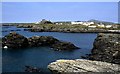
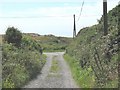
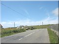
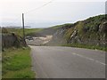
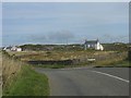
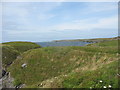
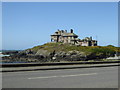
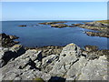
Photos of LL65 2UR
Area Information
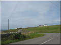
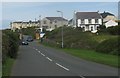
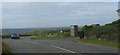
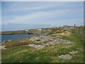
Living in LL65 2UR means inhabiting a small, tightly knit residential cluster in north Wales, where the population of 1053 residents is spread across a low-density area of 67 people per square kilometre. This is not a sprawling suburb but a quiet, compact community where neighbours are likely to know one another. The area’s character is defined by its modest scale and the prevalence of houses, which dominate the housing stock. With a median age of 47 and a majority of residents aged 30–64, the community leans towards middle-aged and older adults, suggesting a stable, long-term presence. Daily life here is likely to revolve around local amenities, with nearby shops, rail links, and airports providing essential connectivity. While the area lacks the vibrancy of larger towns, its simplicity and accessibility to regional hubs like Holyhead make it a practical choice for those seeking a peaceful, low-maintenance lifestyle. The absence of environmental constraints such as protected woodlands or AONB designations means development is unlikely to be restricted, offering potential for future growth or investment.
- Area Type
- Postcode
- Area Size
- Not available
- Population
- 1053
- Population Density
- 67 people/km²
The property market in LL65 2UR is characterised by a high rate of home ownership—82% of residents own their homes—indicating a stable, long-term community rather than a transient rental market. The accommodation type is predominantly houses, which are more common than flats or apartments in this area. This suggests a housing stock that prioritises private, standalone properties, likely catering to families or individuals seeking space and privacy. Given the small population and low density, the number of available properties is limited, meaning buyers may need to consider nearby areas for more options. The high home ownership rate also implies that the area is not a hotspot for speculative investment, but rather a place where residents have a vested interest in maintaining their properties. For buyers, this means a focus on quality, well-maintained homes rather than a rapidly changing market.
House Prices in LL65 2UR
No properties found in this postcode.
Energy Efficiency in LL65 2UR
Residents of LL65 2UR have access to a range of essential amenities within practical reach. Local retail options include Spar, Morrisons Holyhead, and Tesco Holyhead, ensuring everyday shopping needs are met without long journeys. The area’s proximity to Holyhead Railway Station and Valley Railway Station provides reliable connections to regional hubs, while Anglesey Airport offers direct air travel links. Though the area is small, these amenities contribute to a practical, self-sufficient lifestyle. The presence of major supermarkets and rail stations suggests that daily life is focused on convenience and accessibility. While there is no mention of parks or leisure facilities in the data, the rail links and retail options indicate a community that prioritises connectivity over recreational spaces. For those seeking a balance between quiet living and access to services, LL65 2UR offers a straightforward, functional lifestyle.
Amenities
Schools
| Rank | School | Type | Entry gender | Ages |
|---|
Explore more schools in this area
Go to Schools tabDemographics
The community in LL65 2UR is predominantly composed of adults aged 30–64, with a median age of 47. This suggests a mature population, likely with established careers and family ties to the area. Home ownership is high at 82%, indicating a stable, long-term resident base rather than a transient rental market. The accommodation type is primarily houses, reflecting a preference for standalone properties over flats or apartments. The predominant ethnic group is White, with no data provided on other demographics. The population density of 67 people per square kilometre is low, contributing to a less crowded, more spread-out living environment. This density, combined with the high home ownership rate, suggests a community that values privacy and space. The absence of specific data on deprivation or diversity means the area’s social fabric is not fully quantified, but the demographic profile points to a homogeneous, middle-aged population with a strong sense of local identity.
Household Size
Accommodation Type
Tenure
Ethnic Group
Religion
Household Composition
Age
Household Deprivation
NS-SEC
Explore more demographic insights in this area
Go to Demographics tabPlanning
Planning Constraints
- Flood RiskPremium
- Ramsar Wetland SitesPremium
- Area of Outstanding Natural BeautyPremium
- Protected Nature ReservePremium
- Protected WoodlandPremium
- Crime RiskPremium