Area Overview for LL65 2UH
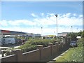
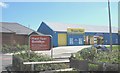
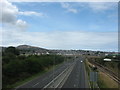
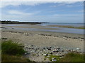
Photos of LL65 2UH


Area Information
LL65 2UH is a compact residential postcode in Wales, covering just 1.9 hectares and home to 1,609 residents. Its high population density of 84,493 people per square kilometre reflects its small, closely knit character. The area is dominated by houses, with 53% of residents owning their homes. Daily life here is shaped by proximity to Holyhead’s amenities, including major retailers like Tesco, Iceland, and Morrisons. The median age of 47 suggests a mature, stable community, with most residents falling within the 30–64 age range. While the area lacks natural designations like AONBs or protected woodlands, its practical location near Holyhead Railway Station and Anglesey Airport makes it a convenient base for commuters and travellers. The low flood risk and absence of planning constraints mean development is unlikely to disrupt the existing residential fabric. For buyers seeking a small, well-connected area with access to retail and transport, LL65 2UH offers a blend of practicality and proximity to essential services.
- Area Type
- Postcode
- Area Size
- 1.9 hectares
- Population
- 1609
- Population Density
- 3253 people/km²
The property market in LL65 2UH is characterised by a 53% home ownership rate, with houses forming the majority of the accommodation stock. This suggests a market skewed towards owner-occupied properties rather than rentals, likely reflecting the area’s family-oriented demographic. The compact size of the postcode—just 1.9 hectares—means the housing stock is limited, and buyers may need to consider nearby areas for more options. The absence of planning constraints such as AONBs or protected woodlands reduces restrictions on development, though the high population density indicates the area is already fully built out. For those seeking a house in a small, well-connected postcode, LL65 2UH offers proximity to Holyhead’s amenities, including retail and transport links. However, the limited size of the area means property availability is constrained, requiring buyers to act swiftly or explore adjacent zones.
House Prices in LL65 2UH
Showing 1 properties
| Address | Type | Beds | Baths | Last Sale Price | Last Sale Date | |
|---|---|---|---|---|---|---|
| Tesco, Petrol Station, Tesco Stores Ltd, Penrhos Retail Park, Holyhead, LL65 2UH | Retail | - | - | - | - |
Energy Efficiency in LL65 2UH
Living in LL65 2UH offers access to Holyhead’s retail and transport hubs, including major supermarkets like Tesco, Iceland, and Morrisons. The area’s proximity to Holyhead Railway Station and Valley Railway Station provides easy access to regional rail services, while Anglesey Airport is within reach for those requiring air travel. Though the data does not mention parks or leisure facilities, the absence of planning constraints like AONBs or protected woodlands suggests the area is focused on residential and commercial use rather than natural recreation. The compact nature of the postcode means amenities are within practical walking or driving distance, fostering a convenient lifestyle. The presence of multiple retail options and transport links indicates a functional, service-oriented environment. While the data does not specify dining or cultural venues, the area’s retail and transport infrastructure supports a practical, everyday rhythm of life.
Amenities
Schools
| Rank | School | Type | Entry gender | Ages |
|---|
Explore more schools in this area
Go to Schools tabDemographics
The population of LL65 2UH is predominantly adults aged 30–64, with a median age of 47. This suggests a community of established professionals and families, rather than students or retirees. Home ownership stands at 53%, indicating a mix of owner-occupied properties and rental units. The accommodation type is primarily houses, reflecting a traditional, family-oriented housing stock. The predominant ethnic group is White, with no data provided on other demographics. The high population density of 84,493 people per square kilometre implies a tightly packed residential area, which may influence social dynamics and local services. While no specific deprivation data is available, the age profile and home ownership rate suggest a relatively stable community with limited reliance on social housing. This demographic profile may appeal to buyers seeking a mature, low-maintenance environment with established infrastructure.
Household Size
Accommodation Type
Tenure
Ethnic Group
Religion
Household Composition
Age
Household Deprivation
NS-SEC
Explore more demographic insights in this area
Go to Demographics tabPlanning
Planning Constraints
- Flood RiskPremium
- Ramsar Wetland SitesPremium
- Area of Outstanding Natural BeautyPremium
- Protected Nature ReservePremium
- Protected WoodlandPremium
- Crime RiskPremium