Area Overview for LL65 1UE
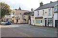
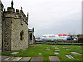
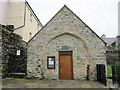
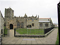
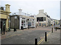
Photos of LL65 1UE


Area Information
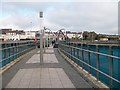
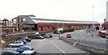
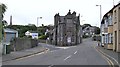
Living in LL65 1UE offers a quiet, tightly knit residential experience within a small cluster of homes in north Wales. With a population of just 1,194, the area feels intimate, where daily life is shaped by proximity to essential services and natural surroundings. The community is predominantly composed of adults aged 30–64, reflecting a mature demographic that values stability. Located in a rural setting, LL65 1UE is accessible via nearby rail links and within reach of Anglesey Airport, making it practical for commuters or those needing regular travel. The area’s compact size means amenities are close at hand, from local shops to transport hubs. While not a bustling urban centre, its charm lies in simplicity—ideal for those seeking a slower pace of life without sacrificing connectivity. The low flood risk and absence of environmental constraints further enhance its appeal, though the lack of detailed crime data for Wales leaves some safety considerations unquantified. For buyers, LL65 1UE represents a blend of practicality and tranquillity, suited to those prioritising convenience and community over city amenities.
- Area Type
- Postcode
- Area Size
- Not available
- Population
- 1194
- Population Density
- Not available
The property market in LL65 1UE is characterised by a 41% home ownership rate, suggesting a balance between owner-occupied homes and rental properties. With houses being the predominant accommodation type, the area likely features family homes and single-family residences rather than apartments or high-density housing. This makes it a more traditional, low-rise neighbourhood, potentially appealing to buyers seeking spacious, private living. However, the small population and limited data on property numbers mean the market is unlikely to be highly competitive. Buyers should consider the area’s proximity to amenities and transport links, such as Holyhead Railway Station and Anglesey Airport, as key selling points. The lack of large-scale development or speculative investment suggests a stable, localised market, though the limited size of LL65 1UE means opportunities for expansion are minimal. For those prioritising a quiet, established community, the housing stock here may offer a straightforward, unpretentious alternative to urban centres.
House Prices in LL65 1UE
No properties found in this postcode.
Energy Efficiency in LL65 1UE
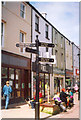
The lifestyle in LL65 1UE is shaped by its proximity to essential amenities, including five retail outlets such as Co-op Holyhead, Lidl Holyhead, and Morrisons Daily. These shops provide access to groceries, household items, and everyday conveniences, reducing the need for long trips. The area’s rail connections to Holyhead and Valley stations, along with Anglesey Airport, enhance its accessibility for both leisure and business travel. While the data does not mention parks or leisure facilities, the absence of environmental constraints like protected woodlands or AONBs suggests open spaces may be available nearby. The compact nature of the area means residents can easily reach services, fostering a self-contained lifestyle. For those valuing convenience over sprawling urban amenities, LL65 1UE offers a practical blend of local shopping, transport, and connectivity.
Amenities
Schools
The nearest school to LL65 1UE is Ysgol Santes Fair, St Mary’s R.C. School, which is listed as an ‘other’ type in the data. No further details on its curriculum, Ofsted rating, or student performance are provided. Families relying on this school would need to consider its proximity and whether it meets their educational preferences, though the absence of specific ratings or reviews limits detailed evaluation. The single school in the area suggests a reliance on local institutions, which may be sufficient for residents’ needs but leaves little room for choice. Parents seeking alternative options, such as private or specialist schools, would need to look beyond LL65 1UE. The lack of additional schools in the data means the area’s educational landscape is not extensively covered, requiring further local investigation for a complete picture.
| Rank | School | Type | Entry gender | Ages |
|---|
Explore more schools in this area
Go to Schools tabDemographics
The demographic profile of LL65 1UE is defined by a median age of 47, with the majority of residents falling within the 30–64 age range. This suggests a community of established professionals and families, many of whom may be retired or in their prime working years. Home ownership stands at 41%, indicating a mix of owner-occupied properties and rental homes, though the exact proportion of renters is not specified. The area is predominantly composed of houses, reflecting a preference for standalone living rather than apartments or flats. The predominant ethnic group is White, with no data provided on other ethnicities. The relatively small population of 1,194 means the area is not highly diverse in terms of cultural or socioeconomic backgrounds. While deprivation data is absent, the presence of essential amenities and low environmental risks implies a baseline quality of life. However, the lack of detailed socioeconomic indicators limits deeper analysis of the community’s needs or challenges.
Household Size
Accommodation Type
Tenure
Ethnic Group
Religion
Household Composition
Age
Household Deprivation
NS-SEC
Explore more demographic insights in this area
Go to Demographics tabPlanning
Planning Constraints
- Flood RiskPremium
- Ramsar Wetland SitesPremium
- Area of Outstanding Natural BeautyPremium
- Protected Nature ReservePremium
- Protected WoodlandPremium
- Crime & SafetyPremium