Area Overview for LL64 5QP
Photos of LL64 5QP
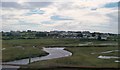
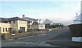
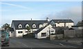
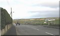
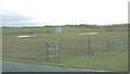
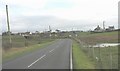
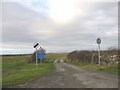
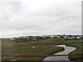
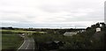
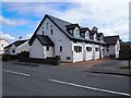
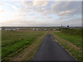
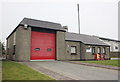
61 photos from this area
Area Information
Key information about the LL64 5QP including its size, population, and administrative classification.
- Area Type
- Postcode
- Area Size
- 2.2 hectares
- Population
- 2095
- Population Density
- 50 people/km²
House Prices in LL64 5QP
41
Properties
£264,174
Average Sold Price
£20,000
Lowest Price
£575,000
Highest Price
Showing 41 properties
| Address | Type | Beds | Baths | Last Sale Price | Last Sale Date | |
|---|---|---|---|---|---|---|
| Pantiles, Station Road, Rhosneigr, LL64 5QP | Semi-detached | 4 | 4 | £575,000 | Feb 2025 | |
| Fern Lodge, 0 Station Road, Rhosneigr, LL64 5QP | house | 7 | 3 | £400,000 | Oct 2022 | |
| Rhysann, 5 Station Road, Rhosneigr, LL64 5QP | house | 6 | - | £517,500 | Jul 2022 | |
| Driftwood, Station Road, Rhosneigr, LL64 5QP | Semi-detached | 7 | 1 | £525,000 | May 2022 | |
| Avalon, Station Road, Rhosneigr, LL64 5QP | Detached | 5 | 2 | £385,000 | Aug 2021 | |
| Penmorfa, Station Road, Rhosneigr, LL64 5QP | Bungalow | - | - | £325,000 | Jul 2021 | |
| Gwel Y Feurig, Station Road, Rhosneigr, LL64 5QP | house | - | - | £521,050 | Jul 2019 | |
| Heathville, Station Road, Rhosneigr, LL64 5QP | house | - | - | £300,000 | Jun 2018 | |
| 1, Christ Church, Station Road, Rhosneigr, LL64 5QP | Semi-detached | - | - | £240,000 | Apr 2017 | |
| Cybi House, Station Road, Rhosneigr, LL64 5QP | house | - | - | £173,000 | Feb 2016 |
Page 1 of 5
Energy Efficiency in LL64 5QP
Amenities
Schools
| Rank | School | Type | Entry gender | Ages |
|---|
Explore more schools in this area
Go to Schools tabDemographics
Household Size
Two person
most common
Accommodation Type
Houses
most common
Tenure
65
majority
Ethnic Group
White
most common
Religion
N/A
most common
Household Composition
N/A
most common
Age
47
median
Adults (30-64 years)
most common
Household Deprivation
N/A
with no deprivation
NS-SEC
30
in Lower managerial occupations
Explore more demographic insights in this area
Go to Demographics tabPlanning
Planning Constraints
- Flood RiskPremium
- Ramsar Wetland SitesPremium
- Area of Outstanding Natural BeautyPremium
- Protected Nature ReservePremium
- Protected WoodlandPremium
- Crime RiskPremium