Area Overview for LL61 6RU
Photos of LL61 6RU
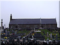
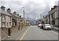
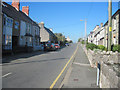
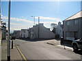
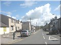
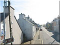

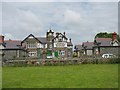
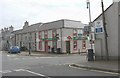
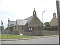
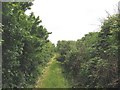
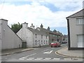
45 photos from this area
Area Information
Key information about the LL61 6RU including its size, population, and administrative classification.
- Area Type
- Postcode
- Area Size
- 2.2 hectares
- Population
- 2232
- Population Density
- 54 people/km²
House Prices in LL61 6RU
29
Properties
£127,786
Average Sold Price
£57,500
Lowest Price
£280,000
Highest Price
Showing 29 properties
| Address | Type | Beds | Baths | Last Sale Price | Last Sale Date | |
|---|---|---|---|---|---|---|
| Gwynant, 2-3 Chapel Street, Newborough, Llanfair Pwllgwyngyll, LL61 6RU | Semi-detached | 3 | 1 | £117,500 | Aug 2025 | |
| Y Bwthyn, Chapel Street, Newborough, Llanfair Pwllgwyngyll, LL61 6RU | Bungalow | 3 | 3 | £240,000 | Feb 2021 | |
| Cae Crwn, Chapel Street, Newborough, Llanfair Pwllgwyngyll, LL61 6RU | Terraced | 4 | 1 | £100,000 | Nov 2020 | |
| Cartref, Chapel Street, Newborough, Llanfair Pwllgwyngyll, LL61 6RU | Detached | 3 | 1 | £97,000 | Jul 2020 | |
| Mor Y Mynydd, Chapel Street, Newborough, Llanfair Pwllgwyngyll, LL61 6RU | Bungalow | 5 | - | £250,000 | Oct 2017 | |
| Tegfan, Chapel Street, Newborough, Llanfair Pwllgwyngyll, LL61 6RU | house | - | - | £95,000 | Sep 2017 | |
| Bod Iorwerth, Chapel Street, Newborough, Llanfair Pwllgwyngyll, LL61 6RU | house | 6 | 3 | £280,000 | Jul 2016 | |
| Corn Coch, Chapel Street, Newborough, Llanfair Pwllgwyngyll, LL61 6RU | Terraced | 3 | - | £86,000 | Apr 2015 | |
| Nisa, Chapel Street, Newborough, Llanfair Pwllgwyngyll, LL61 6RU | house | - | - | £100,000 | Nov 2014 | |
| Tynrardd, Chapel Street, Newborough, Llanfair Pwllgwyngyll, LL61 6RU | Terraced | 3 | 1 | £89,000 | Jun 2014 |
Page 1 of 3
Energy Efficiency in LL61 6RU
Amenities
Schools
| Rank | School | Type | Entry gender | Ages |
|---|
Explore more schools in this area
Go to Schools tabDemographics
Household Size
Two person
most common
Accommodation Type
Houses
most common
Tenure
74
majority
Ethnic Group
White
most common
Religion
N/A
most common
Household Composition
N/A
most common
Age
47
median
Adults (30-64 years)
most common
Household Deprivation
N/A
with no deprivation
NS-SEC
33
in Lower managerial occupations
Explore more demographic insights in this area
Go to Demographics tabPlanning
Planning Constraints
- Flood RiskPremium
- Ramsar Wetland SitesPremium
- Area of Outstanding Natural BeautyPremium
- Protected Nature ReservePremium
- Protected WoodlandPremium
- Crime RiskPremium