Area Overview for LL60 6WD
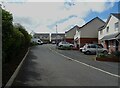
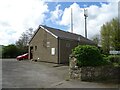
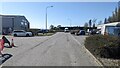
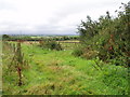
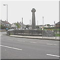
Photos of LL60 6WD


Area Information
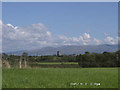
LL60 6WD is a small residential cluster in Wales, home to 2,166 people spread across a low-density area with 64 residents per square kilometre. This is a quiet, compact community where daily life revolves around local amenities and a close-knit environment. The area’s character is defined by its modest scale, with homes predominantly in private ownership and a population skewed towards middle-aged adults. Living here offers a balance of rural tranquillity and accessible transport links, with rail stations within reach and a nearby airport. The presence of shops like Morrisons Daily and Spar ensures basic needs are met locally, while the surrounding landscape remains largely unencumbered by environmental restrictions. For those seeking a peaceful, low-maintenance lifestyle with a strong sense of community, LL60 6WD provides a straightforward, unpretentious setting. Its small size means residents are likely to know their neighbours, and the area’s proximity to transport hubs opens doors to wider opportunities without the pressures of urban living.
- Area Type
- Postcode
- Area Size
- Not available
- Population
- 2166
- Population Density
- 64 people/km²
The property market in LL60 6WD is dominated by owner-occupied homes, with 76% of residents living in properties they own. This high rate of home ownership suggests a stable, long-term market with limited rental activity, which may appeal to buyers seeking investment security. The accommodation type is primarily houses, which aligns with the area’s low-density, residential character. This means the housing stock is likely to consist of semi-detached or detached homes, offering more space than flats but with the compactness of a small area. For buyers, this implies a market where properties are likely to be family-friendly and suited to those prioritising private living over shared spaces. The small size of LL60 6WD means the immediate surroundings are key to understanding the full range of available properties, as the area itself is limited in scale.
House Prices in LL60 6WD
No properties found in this postcode.
Energy Efficiency in LL60 6WD
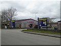
Daily life in LL60 6WD is shaped by its proximity to retail and transport hubs. The area has five notable retail outlets, including Morrisons Daily, Spar, and Lidl Llangefni, providing convenience for shopping and daily essentials. Rail stations within practical reach—Llanfairpwll, Bodorgan, and Bangor—allow easy access to nearby towns, while the Caernarfon metro station adds regional connectivity. The nearby RAF Mona airport, though not a civilian hub, underscores the area’s strategic location. For leisure, the lack of named parks or recreational spaces is compensated by the ease of travel to larger centres. The mix of shops and transport options means residents can enjoy a blend of local convenience and broader opportunities, making it suitable for those who value accessibility without the density of urban living.
Amenities
Schools
The nearest school to LL60 6WD is Ysgol Gynradd Esceifiog, which is categorised as an 'other' type. While no Ofsted rating is provided, the presence of this school indicates access to educational facilities for local children. The single listed school suggests that families may need to consider travel time to other institutions, though the area’s proximity to rail stations like Llanfairpwll and Bangor could ease commutes. The mix of school types is limited here, with only one listed, meaning parents might need to look beyond the immediate area for additional options. For those prioritising a school within walking distance, the availability of this single institution is a key consideration in assessing the area’s suitability for families.
| Rank | School | Type | Entry gender | Ages |
|---|
Explore more schools in this area
Go to Schools tabDemographics
The community in LL60 6WD is predominantly composed of adults aged 30–64, with a median age of 47. This suggests a stable population with a strong presence of middle-aged households, many of whom are likely to be in their peak working years. Home ownership is high, with 76% of residents living in properties they own, indicating a preference for long-term investment in housing. The area’s accommodation is largely made up of houses rather than flats, reflecting a suburban or semi-rural character. The predominant ethnic group is White, though no further breakdown of diversity is provided. The low population density of 64 people per square kilometre suggests a spread-out, perhaps semi-detached or rural housing layout. This demographic profile points to a community focused on stability, with fewer transient residents and a focus on family-oriented living.
Household Size
Accommodation Type
Tenure
Ethnic Group
Religion
Household Composition
Age
Household Deprivation
NS-SEC
Explore more demographic insights in this area
Go to Demographics tabPlanning
Planning Constraints
- Flood RiskPremium
- Ramsar Wetland SitesPremium
- Area of Outstanding Natural BeautyPremium
- Protected Nature ReservePremium
- Protected WoodlandPremium
- Crime RiskPremium