Area Overview for LL60 6AD
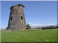
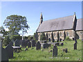
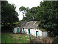
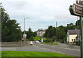
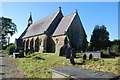
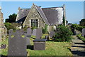
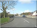
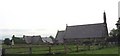
Photos of LL60 6AD


Area Information
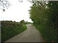
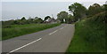
Living in LL60 6AD means inhabiting a small, tightly knit residential cluster in north Wales, where the population of 2166 people spreads across a low-density area of just over 34 km². This is a community defined by its modest scale and practicality, with homes predominantly in single-family structures. The area’s demographic profile suggests a mature, stable population, with a median age of 47 and most residents aged between 30 and 64. Daily life here is shaped by proximity to essential services, including three railway stations—Llanfairpwll, Bodorgan, and Bangor—offering links to larger towns. The area’s compact nature means amenities like shops, schools, and transport hubs are within practical reach, though it remains a quiet, low-traffic environment. With 76% of homes owned outright, LL60 6AD leans toward a settled, owner-occupied demographic, reflecting a community focused on stability rather than transient living.
- Area Type
- Postcode
- Area Size
- Not available
- Population
- 2166
- Population Density
- 64 people/km²
LL60 6AD’s property market is largely owner-occupied, with 76% of homes owned by residents rather than rented. The accommodation type is exclusively houses, suggesting a focus on single-family homes rather than apartments or terraced housing. This makes the area attractive to buyers seeking traditional, spacious properties, though the small population and low density mean the housing stock is limited. The high home ownership rate indicates a stable market, with little turnover. Buyers should consider the area’s proximity to transport links, including three railway stations, and nearby amenities like supermarkets and schools. However, the small size of the postcode means the immediate surroundings, rather than the area itself, may hold more options for property seekers.
House Prices in LL60 6AD
No properties found in this postcode.
Energy Efficiency in LL60 6AD
Residents of LL60 6AD have access to five retail outlets, including Morrisons Daily, Spar, and Lidl Llangefni, ensuring basic shopping needs are met locally. The three railway stations provide links to nearby towns, while RAF Mona offers a unique, if niche, transport option. The area’s low density means parks and leisure facilities are not explicitly listed, but the proximity to natural landscapes—such as the Menai Strait and Anglesey’s countryside—may offer informal outdoor spaces. The combination of practical amenities and transport links creates a lifestyle focused on convenience and connectivity, with a quiet, rural backdrop.
Amenities
Schools
The nearest school to LL60 6AD is Ysgol Gynradd Esceifiog, which is categorised as an “other” type in the data. No Ofsted rating is provided, so its quality remains unspecified. Families in the area must rely on this single school for primary education, though no details on its capacity, performance, or facilities are available. The absence of additional schools suggests limited options for parents, particularly if the local school is oversubscribed or does not meet specific needs. Given the area’s small size, parents may need to look beyond LL60 6AD for secondary education or specialist provisions.
| Rank | School | Type | Entry gender | Ages |
|---|
Explore more schools in this area
Go to Schools tabDemographics
LL60 6AD’s population skews toward adults aged 30 to 64, with a median age of 47, indicating a community of established professionals and families. Home ownership is high at 76%, suggesting most residents are long-term residents rather than renters. The area is predominantly composed of houses, with no mention of flats or shared accommodation, pointing to a traditional, family-oriented housing stock. The predominant ethnic group is White, with no data on other demographics provided. The low population density of 64 people per km² reflects a spread-out, rural or semi-rural character, where private homes dominate. This profile aligns with a community prioritising stability, with limited evidence of transient or younger populations.
Household Size
Accommodation Type
Tenure
Ethnic Group
Religion
Household Composition
Age
Household Deprivation
NS-SEC
Explore more demographic insights in this area
Go to Demographics tabPlanning
Planning Constraints
- Flood RiskPremium
- Ramsar Wetland SitesPremium
- Area of Outstanding Natural BeautyPremium
- Protected Nature ReservePremium
- Protected WoodlandPremium
- Crime RiskPremium