Area Overview for LL59 5RW
Photos of LL59 5RW
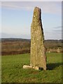

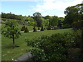


102 photos from this area
Area Information
Key information about the LL59 5RW including its size, population, and administrative classification.
- Area Type
- Postcode
- Area Size
- 86.6 hectares
- Population
- 2041
- Population Density
- 812 people/km²
House Prices in LL59 5RW
12
Properties
£60,000
Average Sold Price
£60,000
Lowest Price
£60,000
Highest Price
Showing 12 properties
| Address | Type | Beds | Baths | Last Sale Price | Last Sale Date | |
|---|---|---|---|---|---|---|
| Pedair Groeslon, Pentraeth Road, Menai Bridge, LL59 5RW | Bungalow | 2 | 1 | £60,000 | Jul 1997 | |
| Carreg Iago, Pentraeth Road, Menai Bridge, LL59 5RW | Land | - | - | - | - | |
| Jones Peckover, Britannia House, Pentraeth Road, Menai Bridge, LL59 5RW | Office | - | - | - | - | |
| Highways Company, Four Crosses Units, Pentraeth Road, Menai Bridge, LL59 5RW | Industrial | - | - | - | - | |
| Flat, Siop Newydd, Gors Goch, Menai Bridge, LL59 5RW | Flat | - | - | - | - | |
| Window Medic, 2, Britannia House, Pentraeth Road, Menai Bridge, LL59 5RW | shop | - | - | - | - | |
| Four Crosses Construction, First Floor, Britannia House, Pentraeth Road, Menai Bridge, LL59 5RW | Office | - | - | - | - | |
| 2C, Four Crosses Units, Pentraeth Road, Menai Bridge, LL59 5RW | Industrial | - | - | - | - | |
| Maen Hir, Maen Hir Guesthouse, Pentraeth Road, Menai Bridge, LL59 5RW | Semi-detached | - | - | - | - | |
| Bwthyn Yr Allt, Pentraeth Road, Menai Bridge, LL59 5RW | Detached | - | - | - | - |
Page 1 of 2
Energy Efficiency in LL59 5RW
Amenities
Schools
| Rank | School | Type | Entry gender | Ages |
|---|
Explore more schools in this area
Go to Schools tabDemographics
Household Size
One person
most common
Accommodation Type
Houses
most common
Tenure
72
majority
Ethnic Group
White
most common
Religion
N/A
most common
Household Composition
N/A
most common
Age
47
median
Adults (30-64 years)
most common
Household Deprivation
N/A
with no deprivation
NS-SEC
34
in Lower managerial occupations
Explore more demographic insights in this area
Go to Demographics tabPlanning
Planning Constraints
- Flood RiskPremium
- Ramsar Wetland SitesPremium
- Area of Outstanding Natural BeautyPremium
- Protected Nature ReservePremium
- Protected WoodlandPremium
- Crime RiskPremium