Area Overview for LL59 5EA
Photos of LL59 5EA


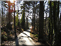
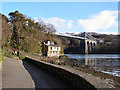
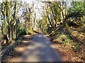
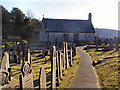


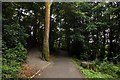
100 photos from this area
Area Information
Key information about the LL59 5EA including its size, population, and administrative classification.
- Area Type
- Postcode
- Area Size
- 7.4 hectares
- Population
- 1005
- Population Density
- 1023 people/km²
House Prices in LL59 5EA
17
Properties
£126,650
Average Sold Price
£25,000
Lowest Price
£225,000
Highest Price
Showing 17 properties
| Address | Type | Beds | Baths | Last Sale Price | Last Sale Date | |
|---|---|---|---|---|---|---|
| Dolgoed, Mona Road, Menai Bridge, LL59 5EA | Detached | 4 | - | £225,000 | Mar 2016 | |
| Pinewood, Mona Road, Menai Bridge, LL59 5EA | Detached | - | - | £129,950 | Dec 2007 | |
| The Vicarage, Mona Road, Menai Bridge, LL59 5EA | house | - | - | £25,000 | Feb 1997 | |
| Police House 2, Police Station, Mona Road, Menai Bridge, LL59 5EA | commercial | - | - | - | - | |
| Police House 1, Police Station, Mona Road, Menai Bridge, LL59 5EA | commercial | - | - | - | - | |
| 1, Argoed Flats, Mona Road, Menai Bridge, LL59 5EA | Flat | - | - | - | - | |
| The Flat, Anglesey Arms, Mona Road, Menai Bridge, LL59 5EA | restaurant_cafe | - | - | - | - | |
| Refuse Collection Point, Mona Road, Menai Bridge, LL59 5EA | Industrial | - | - | - | - | |
| Woodlands Dental Surgery, Mona Road, Menai Bridge, LL59 5EA | primary_healthcare | - | - | - | - | |
| Menai Bridge Town Council, Canolfan Coed Cyrnol, Mona Road, Menai Bridge, LL59 5EA | Office | - | - | - | - |
Page 1 of 2
Energy Efficiency in LL59 5EA
Amenities
Schools
| Rank | School | Type | Entry gender | Ages |
|---|
Explore more schools in this area
Go to Schools tabDemographics
Household Size
One person
most common
Accommodation Type
Houses
most common
Tenure
67
majority
Ethnic Group
White
most common
Religion
N/A
most common
Household Composition
N/A
most common
Age
47
median
Adults (30-64 years)
most common
Household Deprivation
N/A
with no deprivation
NS-SEC
46
in Lower managerial occupations
Explore more demographic insights in this area
Go to Demographics tabPlanning
Planning Constraints
- Flood RiskPremium
- Ramsar Wetland SitesPremium
- Area of Outstanding Natural BeautyPremium
- Protected Nature ReservePremium
- Protected WoodlandPremium
- Crime RiskPremium