Area Overview for LL58 8HU
Photos of LL58 8HU
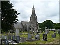
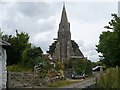
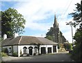
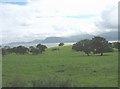
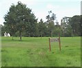
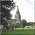
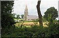
67 photos from this area
Area Information
Key information about the LL58 8HU including its size, population, and administrative classification.
- Area Type
- Postcode
- Area Size
- 53.1 hectares
- Population
- 1612
- Population Density
- 189 people/km²
House Prices in LL58 8HU
18
Properties
£871,667
Average Sold Price
£240,000
Lowest Price
£1,600,000
Highest Price
Showing 18 properties
| Address | Type | Beds | Baths | Last Sale Price | Last Sale Date | |
|---|---|---|---|---|---|---|
| Henllys Barnhouse, Entrance To Henllys Hall, Llanfaes, Beaumaris, LL58 8HU | Detached | 4 | - | £775,000 | Nov 2021 | |
| Henllys Farmhouse, Entrance To Henllys Hall, Llanfaes, Beaumaris, LL58 8HU | house | - | - | £1,600,000 | Jul 2018 | |
| Henllys Lodge, Entrance To Henllys Hall, Llanfaes, Beaumaris, LL58 8HU | Bungalow | 2 | 1 | £240,000 | Dec 2016 | |
| Henllys Hall, Entrance To Henllys Hall, Llanfaes, Beaumaris, LL58 8HU | Detached | 4 | - | - | - | |
| Hart Leap Well, Entrance To Henllys Hall, Llanfaes, Beaumaris, LL58 8HU | Detached | - | - | - | - | |
| 6, Henllys Apartments, Entrance To Henllys Hall, Llanfaes, Beaumaris, LL58 8HU | Flat | - | - | - | - | |
| 1, Henllys Apartments, Entrance To Henllys Hall, Llanfaes, Beaumaris, LL58 8HU | Flat | - | - | - | - | |
| 2, Henllys Apartments, Entrance To Henllys Hall, Llanfaes, Beaumaris, LL58 8HU | Flat | - | - | - | - | |
| 3, Henllys Apartments, Entrance To Henllys Hall, Llanfaes, Beaumaris, LL58 8HU | Flat | - | - | - | - | |
| 7, Henllys Apartments, Entrance To Henllys Hall, Llanfaes, Beaumaris, LL58 8HU | Flat | - | - | - | - |
Page 1 of 2
Energy Efficiency in LL58 8HU
Amenities
Schools
| Rank | School | Type | Entry gender | Ages |
|---|
Explore more schools in this area
Go to Schools tabDemographics
Household Size
Two person
most common
Accommodation Type
Houses
most common
Tenure
62
majority
Ethnic Group
White
most common
Religion
N/A
most common
Household Composition
N/A
most common
Age
47
median
Adults (30-64 years)
most common
Household Deprivation
N/A
with no deprivation
NS-SEC
33
in Lower managerial occupations
Explore more demographic insights in this area
Go to Demographics tabPlanning
Planning Constraints
- Flood RiskPremium
- Ramsar Wetland SitesPremium
- Area of Outstanding Natural BeautyPremium
- Protected Nature ReservePremium
- Protected WoodlandPremium
- Crime RiskPremium