Area Overview for Cwm Cadnant Community
Photos of Cwm Cadnant Community
Area Information
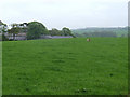
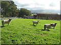
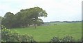
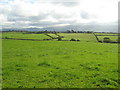
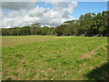
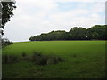
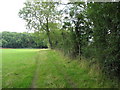
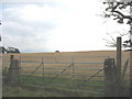
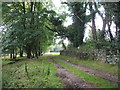
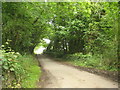
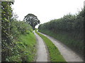
Cwm Cadnant Community stands as a rural parish in Wales, covering an area of 19.0 square kilometres. Living in this location offers a distinctly quiet lifestyle, far removed from urban density. The terrain is defined by the parish boundaries and natural features such as protected woodland and nature reserves. Due to its civil parish status, the area maintains a strong connection to local heritage and agricultural roots. Residents benefit from proximity to designated Areas of Outstanding Natural Beauty, which imposes specific planning constraints to preserve the landscape. You will find that daily life revolves around the pace of the countryside rather than city centres. The population is concentrated in homes spread across the parish. This setting is ideal for those seeking space and a slower rhythm. However, the environmental designations mean development is tightly controlled. You must navigate planning restrictions if you consider building extensions or purchasing land. The area is defined by its green spaces and the fact that it contains elements of the broader regional conservation network. Homes here offer a direct link to the outdoors.
- Area Type
- Parish
- Area Size
- 19.0 km²
- Population
- Not available
- Population Density
- Not available
Demographics
The community in Cwm Cadnant Community is defined by an older population. The median age of residents is 70 years, which significantly influences the character of the neighbourhood. Most households consist of total adult residents rather than families with young children. This demographic profile suggests a village shaped by retirees and long-term locals. Home ownership is extremely high, standing at 84 per cent of all households. This figure indicates that most people in Cwm Cadnant Community have purchased their properties outright or through a mortgage decades ago. Rental properties are rare and account for the remaining 16 per cent of households. The area does not show specific data on dominant ethnic groups or religious affiliations in the provided records. Deprivation levels are not specified in the available figures for this parish. The high proportion of owner-occupiers typically correlates with stable, long-standing community ties. You should expect a neighbourly environment where families and seniors support one another. The age structure means fewer schools nearby, which affects family planning.
Household Size
Accommodation Type
Tenure
Ethnic Group
Religion
Household Composition
Age
Household Deprivation
NS-SEC
Explore more demographic insights in this area
Go to Demographics tabPlanning
Planning Constraints
- Flood RiskPremium
- Ramsar Wetland SitesPremium
- Area of Outstanding Natural BeautyPremium
- Protected Nature ReservePremium
- Protected WoodlandPremium
- Crime RiskPremium