Area Overview for Bodorgan Community
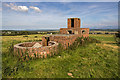
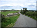
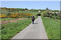
Photos of Bodorgan Community

Area Information
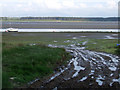
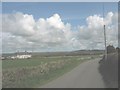
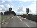
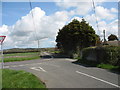
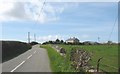
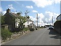
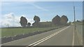
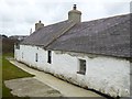
Living in Bodorgan Community offers a distinct experience defined by its rural character and quiet pace. This civil parish covers an area of 26.0 km², creating a compact neighbourhood where residents enjoy close proximity to the natural surroundings of Milford Haven. You will find a locale that prioritises access to green spaces over urban convenience, suitable for those seeking a retreat from city life. The demographic profile reveals a community settled by older generations, which shapes the daily rhythm of the town. With a median age of 70, the population leans heavily towards retirees and those past the prime working age. This is not a bustling hub for young families or commuters, but a tranquil retirement village where life moves slowly. The high home ownership rate suggests stability within neighbourhood blocks, with long-term residents likely to know several generations. Homes in Bodorgan Community are primarily single-family dwellings suited to independent living rather than dense urban flats. You should expect a residential environment shaped by the needs of an ageing population. Daily life revolves around local amenities rather than a vibrant commercial centre, as the design of the area caters to permanent settlement. This makes it an ideal choice if you value peace and solitude over proximity to fast-paced developments. The combination of an AONB designation and specific nature reserves ensures your view will often include protected landscapes rather than industrial buildings.
- Area Type
- Parish
- Area Size
- 26.0 km²
- Population
- Not available
- Population Density
- Not available
Demographics
The population of Bodorgan Community reflects a homogenous community populated largely by older residents. The median age figures at 70, indicating that half the population is over this age while the younger demographic is significantly smaller. This age profile creates a quiet atmosphere where the weekday population may shrink compared to weekend figures. Most people living in Bodorgan Community are active in retirement, engaging in leisure activities rather than daily commuting. You will encounter a stable community structure where the vast majority of residents have stayed for many years. Data confirms that 72% of the local population owns their homes entirely. This statistic highlights a region where buying a plot is viewed as a serious long-term investment rather than a transitional step. The remaining 28% likely rent properties that serve as homes for those unable to afford mortgages or who prefer flexibility. Diversity metrics and household composition data point towards a uniform community. The predominant ethnic group remains the British majority, consistent with other rural Welsh parishes. You will find few young professionals or students living in Bodorgan Community. Schools near this area are likely restricted to special educational needs settings or rely on transport links for distant students. The lack of a mixed-age mix means you will not find the energy typical of university towns or commercial centres. This demographic reality defines the character of every street in the parish.
Household Size
Accommodation Type
Tenure
Ethnic Group
Religion
Household Composition
Age
Household Deprivation
NS-SEC
Explore more demographic insights in this area
Go to Demographics tabPlanning
Planning Constraints
- Flood RiskPremium
- Ramsar Wetland SitesPremium
- Area of Outstanding Natural BeautyPremium
- Protected Nature ReservePremium
- Protected WoodlandPremium
- Crime RiskPremium