Area Overview for Amlwch Community
Photos of Amlwch Community
Area Information
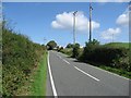
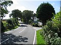
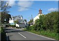
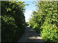
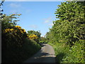
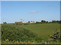
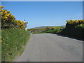
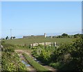
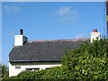
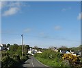
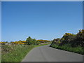
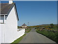
Amlwch Community is a civil parish located in Wales, covering a geographical area of 18.3 km². Living in this part of Anglesey offers residents a distinct小包 setting defined by its rural character rather than urban density. The community acts as a local hub within a wider parliamentary constituency, providing a sense of place that many seek when looking for homes in this region. Daily life here revolves around the quiet pace of a parish settlement, where the physical scale directly influences the neighbourhood atmosphere. You will find that the environment prioritizes open spaces over high-rise development, creating a living environment that feels separate from major city centres. This status as a civil parish means you are settled in an area with established local governance boundaries but limited infrastructure compared to larger towns. The 18.3 km² footprint ensures that travel distances within the parish are generally manageable, yet commuting to larger centres may require significant time. When considering homes in Amlwch Community, you should expect a landscape shaped by its coastal and inland positions within the parish limits. The area does not boast extensive public transport networks or large commercial centres within its borders, which defines the typical resident's lifestyle choices.
- Area Type
- Parish
- Area Size
- 18.3 km²
- Population
- Not available
- Population Density
- Not available
Demographics
People living in Amlwch Community represent a significantly older demographic compared to the national average, with a median age of 70 years. This figure indicates that the resident population is heavily weighted towards retirees and older adults, forming the core of households built to accommodate this lifestyle. The most common age range data confirms that the total age profile skews heavily towards those over retirement age, suggesting a quiet environment ideal for older couples or those seeking a slower pace of life. Home ownership stands at 65 per cent across the parish, meaning three out of every four residents own their homes outright or with a mortgage. This high level of ownership suggests stable, long-term residents who have likely raised families here in previous generations or downsized to retirement properties later in life. Household composition reflects this profile, with a majority of families likely consisting of one or two people rather than large families with school-age children. The accommodation type mix aligns with this demographic, featuring properties suited for single occupancy or couples. Diversity in ethnic groups and religious practices is not detailed in the available census breakdowns for this specific parish, but the age data paints a clear picture of who calls this part of Wales home today.
Household Size
Accommodation Type
Tenure
Ethnic Group
Religion
Household Composition
Age
Household Deprivation
NS-SEC
Explore more demographic insights in this area
Go to Demographics tabPlanning
Planning Constraints
- Flood RiskPremium
- Ramsar Wetland SitesPremium
- Area of Outstanding Natural BeautyPremium
- Protected Nature ReservePremium
- Protected WoodlandPremium
- Crime RiskPremium