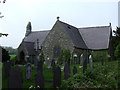
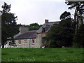
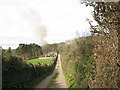
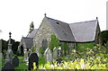
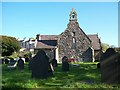
Area Overview for Llangoed Community
Photos of Llangoed Community


Area Information
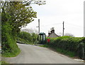
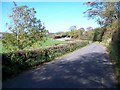
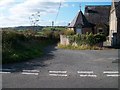
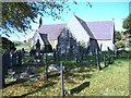
Living in Llangoed Community offers a distinct experience within a civil parish that spans 10.3 square kilometres. You enter a setting defined by its specific geographic constraints and natural features rather than high-density urban development. The area currently identifies as a rural locality where the daily rhythm is shaped by local geography. This parish sits between the larger towns of Drefach Feliat and Cwmavon, creating a semi-rural environment. The land size suggests limited space for expansion, which influences the character of the neighbourhood. Residents here experience a location that balances isolation with proximity to established services. The area classification as a civil parish indicates a specific level of local governance and community structure. You find yourself in a zone where the landscape dictates the layout of the homes. The physical footprint of 10.3 km² means every street corner carries weight. This small compass ensures that local amenities remain central to daily life. The absence of major industrial zones within this specific boundary reinforces a residential focus. You are looking at a community where the environment has shaped the housing stock. The location offers a quiet existence for those who value proximity to natural features without needing to live inside a national park. The specific designation of the parish provides a framework for understanding the local services available to you.
- Area Type
- Parish
- Area Size
- 10.3 km²
- Population
- Not available
- Population Density
- Not available
Demographics
The demographic profile of Llangoed Community reveals an exceptionally mature population. The median age stands at 70 years, confirming that residents here are significantly older than the national average. Nearly all households in this parish fall into the broadest age category, indicating a lack of young families or children. You are dealing with a community dominated by an older demographic. This age distribution suggests a retirement-focused environment where neighbours likely share similar life stages and interests. Home ownership remains the defining feature of the housing market, with 75% of residents owning their property outright. This high rate indicates long-term stability within the community. The remaining 25% likely consist of renters who fit the existing age demographic. There is no indication of recent migration driving diversity at this time. The household composition points to single-person homes or couples living in established residences. Every statistic reinforces the image of a settled, older population. You will not find the energetic turnover typical of family hubs in this area. The data paints a clear picture of a quiet community where residents have likely lived for decades. This stability means that local traditions and social networks remain fixed over time.
Household Size
Accommodation Type
Tenure
Ethnic Group
Religion
Household Composition
Age
Household Deprivation
NS-SEC
Explore more demographic insights in this area
Go to Demographics tabPlanning
Planning Constraints
- Flood RiskPremium
- Ramsar Wetland SitesPremium
- Area of Outstanding Natural BeautyPremium
- Protected Nature ReservePremium
- Protected WoodlandPremium
- Crime RiskPremium