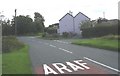
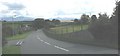
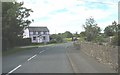
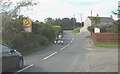
Area Overview for Llanddona Community
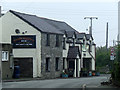
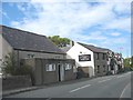
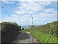
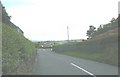
Photos of Llanddona Community

Area Information
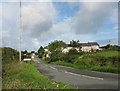
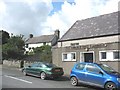
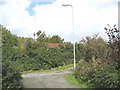
Living in Llanddona Community offers a distinct experience within the civil parish of the same name. This built-up area spans 17.4 km², providing a spread-out environment for residents. The location sits in Wales, offering a backdrop of natural beauty that influences daily life. You will find that the community is compact enough to navigate easily yet large enough to offer variety. The parish definition suggests a degree of local governance and community identity that is central to life here. The area functions as a self-contained locale where residents manage their daily routines within a specific geographic footprint. There are no major urban centres immediately adjacent, which shapes the rhythm of your week. You buy into a lifestyle defined by its boundaries and its rural character. The size of the parish means you are not living in a dense urban block but in a space that requires some travel for broader amenities. When you consider homes in Llanddona Community, you are choosing a setting where local infrastructure supports a slower pace. The land use is dictated by the boundaries of this civil parish, ensuring a consistent character across the settlement. You live among neighbours who share the same geographic designation and local interests. This clear administrative status helps you understand the jurisdiction and services available to you.
- Area Type
- Parish
- Area Size
- 17.4 km²
- Population
- Not available
- Population Density
- Not available
Demographics
The demographic profile of Llanddona Community presents an older population cohort. You will encounter a community where 73% of residents own their homes. This high level of ownership often correlates with stability and long-term settlement patterns. The median age of 70 years indicates that retirees dominate the resident population. You are likely to engage with neighbours who have lived in the area for decades, if not their whole life. Household composition data reflects the reality that many residents do not have young children or large families living with them. The total household figures show a population accustomed to this older age profile. You will not find a massive influx of teenagers or young professionals moving into the parish. Instead, the social fabric revolves around the needs and interactions of senior citizens. This demographic reality shapes local shops, social clubs, and community activities. The area people speak here are those who have weathered various decades of life together. You live in a neighbourhood where generations often converse while taking a bus or walking in the village. The high home ownership rate means most houses in Llanddona Community are passed down or purchased for retirement rather than rented out. You can expect a quieter atmosphere compared to younger, family-centric communities.
Household Size
Accommodation Type
Tenure
Ethnic Group
Religion
Household Composition
Age
Household Deprivation
NS-SEC
Explore more demographic insights in this area
Go to Demographics tabPlanning
Planning Constraints
- Flood RiskPremium
- Ramsar Wetland SitesPremium
- Area of Outstanding Natural BeautyPremium
- Protected Nature ReservePremium
- Protected WoodlandPremium
- Crime RiskPremium