Area Overview for Llanfair Pwllgwyngyll Community
Photos of Llanfair Pwllgwyngyll Community

Area Information
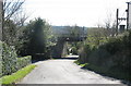
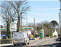
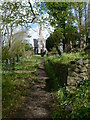
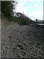
Living in Llanfair Pwllgwyngyll Community offers a distinct experience within a civil parish defined by its rural character. This parish spans 3.8 square kilometres, creating a small yet meaningful territorial footprint where daily life moves at a slower pace. You will find yourself in a location that prioritises green space and established neighbourhoods over urban density. The area is situated in Wales, fitting into the wider cultural and geographical context of the UK. Prospective residents should understand the scale and setting immediately; this is a compact community where amenities are likely local, and the environment plays a central role in daily routine. The designation as a civil parish confirms its status as a local administrative unit with specific governance structures. Whether you are looking for homes in Llanfair Pwllgwyngyll Community or seeking schools near Llanfair Pwllgwyngyll Community, the setting provides a clear, manageable geography. The area size dictates that travel times between points are short, yet the location remains firmly rooted in its Welsh heritage. You can expect a landscape shaped by nature and history rather than modern expansion. This specific identity means you are entering a zone with defined boundaries and a character that has evolved over many years. The combination of a modest area size and civil parish status creates a focused living environment.
- Area Type
- Parish
- Area Size
- 3.8 km²
- Population
- Not available
- Population Density
- Not available
Demographics
The demographic profile of Llanfair Pwllgwyngyll Community reveals a population with a significantly older age structure. The median age stands at 70 years, indicating that residents are primarily seniors. This age distribution suggests a retirement or established community dynamic. You will encounter a neighbourhood where life pace aligns with retirement habits rather than young family expansion. The most common age range data indicates 'Age: Total', confirming that the age spread is broad, yet the central tendency remains high. Homeownership is deeply entrenched in this community, with 79 per cent of residents owning their properties. This high level of ownership implies long-term stability and a high success rate at obtaining mortgages or inheriting homes. Household composition and accommodation type data are presented as 'total', reflecting the aggregate nature of the parish statistics. While specific ethnic group and religion data are not detailed as percentages, the historical context of Wales suggests a predominantly non-diverse population. You can expect a homogeneous community where social networks have developed over generations. For you as a buyer, this means the area is suited to those seeking quiet retirement or stability. The high ownership rate means rental demand may be lower compared to younger urban markets. Living in Llanfair Pwllgwyngyll Community requires acceptance of an older demographic norm.
Household Size
Accommodation Type
Tenure
Ethnic Group
Religion
Household Composition
Age
Household Deprivation
NS-SEC
Explore more demographic insights in this area
Go to Demographics tabPlanning
Planning Constraints
- Flood RiskPremium
- Ramsar Wetland SitesPremium
- Area of Outstanding Natural BeautyPremium
- Protected Nature ReservePremium
- Protected WoodlandPremium
- Crime RiskPremium