Area Overview for Menai Bridge Community
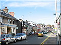
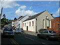
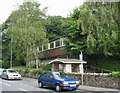
Photos of Menai Bridge Community


Area Information
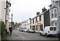
Living in Menai Bridge Community offers a distinct experience within a civil parish that spans just 3.7 square kilometres. This small footprint concentrates daily life for residents, creating an environment where the local area feels intimate and defined. The community sits in Wales, providing a specific regional context that shapes the rhythm of life here. You will find a settlement that is not expansive, yet it serves as a focal point for those seeking a home in this part of the country. The physical boundaries are clear, meaning you quickly become familiar with the limits of your surroundings. This compact size influences how people move through the parish and how services are accessed within the immediate vicinity. Daily life revolves around a central point that makes logistics straightforward for households. The area does not sprawl out indefinitely, which often means longer commutes depend on transport connections rather than driving distance alone. You interact with a community where the scale allows for a clear understanding of local dynamics without the anonymity of larger cities. Residents know their neighbours, and the small geographical area fosters a sense of place that is hard to replicate in more rural or urban settings. When you consider buying homes in Menai Bridge Community, you are entering a space with defined edges and a concentrated population. This structure supports a lifestyle where the built environment and natural constraints are immediately apparent. The parish limits dictate the pace of development and the character of the streets you walk. You gain immediate awareness of the area's containment once you arrive. This reality shapes your appreciation of the locale from the moment you walk through the front door. The confines of the parish mean every corner is significant to the local identity. You can navigate the entirety of Menai Bridge Community with ease, knowing exactly where the boundaries lie. This clarity defines the experience of living in the area.
- Area Type
- Parish
- Area Size
- 3.7 km²
- Population
- Not available
- Population Density
- Not available
Demographics
The people who live in Menai Bridge Community represent a specific demographic profile that shapes the character of the parish. The median age across the population stands at 70, indicating that an older demographic dominates the resident base. This age figure suggests a community where retirement living or later-life residence is common. The most common age range recorded is simply Age: Total, reflecting the broad composition of the settlement. You should expect a population heavy towards the senior end of the life spectrum when you evaluate homes in Menai Bridge Community. Home ownership levels are notably high, with 70% of residents owning their property. This statistic confirms that the area is primarily an owner-occupied market rather than a rental hub. The high ownership percentage points to a stable community where long-term residents hold their stakes in the local housing stock. Accommodation types are logged under a total category, suggesting a uniformity in housing stock that aligns with the owner-occupied majority. There is no significant data on predominant ethnic groups or religious affiliations within the provided records, so diversity or faith-based communities are not statistically defined here. Household composition data is also recorded as a total, meaning specific details about family sizes or single-person households are not broken down further. This lack of granularity limits the ability to describe mixed-age or multi-generational living arrangements with precision. The population makeup is therefore best described by the age and ownership figures available. When you look for homes in Menai Bridge Community, you are entering an environment where the age profile and ownership status are the defining features. The 70% ownership rate is a concrete fact that assists in understanding the financial expectations of the local market. The age data reinforces the notion of a quiet, settled community.
Household Size
Accommodation Type
Tenure
Ethnic Group
Religion
Household Composition
Age
Household Deprivation
NS-SEC
Explore more demographic insights in this area
Go to Demographics tabPlanning
Planning Constraints
- Flood RiskPremium
- Ramsar Wetland SitesPremium
- Area of Outstanding Natural BeautyPremium
- Protected Nature ReservePremium
- Protected WoodlandPremium
- Crime RiskPremium