Area Overview for Llanllechid Community
Photos of Llanllechid Community
Area Information
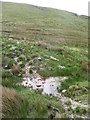
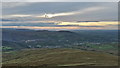
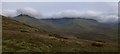
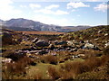
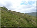
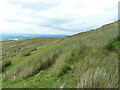
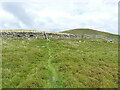
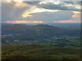
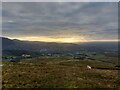
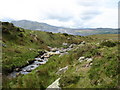
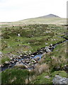
Living in Llanllechid Community defines a lifestyle rooted in rural tranquillity within the population of a civil parish in Wales. The area spans 48.0 km², offering expansive countryside and a distinctly small-town feel away from the pressures of major urban centres. You are entering a community where daily life moves at a steady pace, characterised by open spaces and a quiet atmosphere. This locality sits comfortably in the Welsh landscape, providing residents with access to nature without the density of larger settlements. The parish structure supports local governance and community cohesion, ensuring that decision-making remains focused on the specific needs of those calling this place home. Prospective buyers looking for a home in Llanllechid Community will find an environment that prioritises heritage and natural beauty over rapid development. The large landmass allows for varied housing styles, from traditional cottages to modern developments, all coexisting within the parish boundaries. It is a place where the connection to the land shapes the character of the neighbourhood. You will perceive a setting that rewards those who value space and independence over city conveniences. This makes the area an attractive option for those seeking a meaningful, grounded existence in the heart of Wales.
- Area Type
- Parish
- Area Size
- 48.0 km²
- Population
- Not available
- Population Density
- Not available
Demographics
The community in Llanllechid Community displays a clear demographic profile, dominated by an older population. The median age reaches 70, which indicates that the area is settled by mature residents rather than young families or workers. This age distribution suggests a quiet demographic environment where social activities and community life cater to retirement needs and established lifestyles. Regarding who lives in Llanllechid Community, a significant majority of the population owns their homes, with home ownership standing at 67%. This high percentage of owner-occupiers creates a stable community atmosphere where residents have deep roots in the parish. The household composition and accommodation type data confirm that the area does not rely heavily on private renting or transient populations. Diverse household types exist, but the overarching narrative is one of long-term residency. The lack of data on ethnicity and religion means the public record focuses on these tangible metrics of stability. For you as a buyer, understanding that most people live here means entering a network of established neighbours. The low influx of newcomers aligns with the older median age, creating a predictable and calm living environment.
Household Size
Accommodation Type
Tenure
Ethnic Group
Religion
Household Composition
Age
Household Deprivation
NS-SEC
Explore more demographic insights in this area
Go to Demographics tabPlanning
Planning Constraints
- Flood RiskPremium
- Ramsar Wetland SitesPremium
- Area of Outstanding Natural BeautyPremium
- Protected Nature ReservePremium
- Protected WoodlandPremium
- Crime RiskPremium