Area Overview for Llanengan Community
Photos of Llanengan Community
Area Information
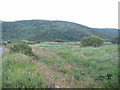
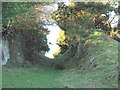
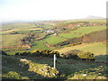
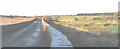
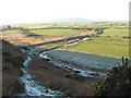
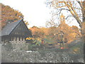
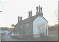
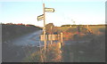
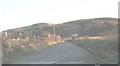
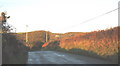
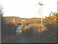
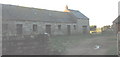
Living in Llanengan Community offers a distinct experience defined by its rural character and compact size. This civil parish covers an extensive 35.4 km², providing enough space for open landscapes while maintaining a close-knit feel. The area is situated in Wales, a location that shapes its natural beauty and community focus. A median age of 70 reveals a population heavily weighted towards older residents, creating a quiet environment different from many bustling urban centres. Daily life here centres around the local needs of a predominantly elderly demographic rather than the demands of a young workforce or busiest times for schools. You will find a setting where the pace of life is slower, favoured by those seeking retirement or peace away from city noise. The total area size ensures there are few built-up pressures, allowing nature to remain prominent in the daily view. This makes Llanengan Community an ideal choice for buyers who prioritise space and tranquillity over rapid transaction speeds or proximity to major cities. The large land mass also suggests varied topography, though specific terrain details rely on your own exploration of the 35.4 km² landscape. Ultimately, choosing homes in Llanengan Community means opting for a stable, mature environment where the community structure revolves around long-term residency.
- Area Type
- Parish
- Area Size
- 35.4 km²
- Population
- Not available
- Population Density
- Not available
Demographics
The community profile of Llanengan Community is shaped almost entirely by an older population. With a median age of 70, you are living in an area where the majority of residents have likely moved here for retirement or are staying put as they grow older. This age distribution means household dynamics will typically feature couples living together or individuals managing homes alone. You can expect a generation that values stability and established routines over rapid lifestyle changes. Home ownership stands at a significant 67%, indicating that most residents have built lasting roots in their properties rather than renting. This high ownership rate suggests a stable, invested community where people do not move frequently. While the area lacks detailed breakdowns on ethnicity or religious affiliation in the current records, the demographic focus remains firmly on age and stability. The household composition reflects this, showing a total profile that aligns with the older demographic trends. For buyers assessing schools near Llanengan Community, the low school population implied by the age profile means facilities may serve a different purpose or rely on regional integration. The quality of life here is driven by the presence of neighbours with shared life stages and a strong sense of established tenure.
Household Size
Accommodation Type
Tenure
Ethnic Group
Religion
Household Composition
Age
Household Deprivation
NS-SEC
Explore more demographic insights in this area
Go to Demographics tabPlanning
Planning Constraints
- Flood RiskPremium
- Ramsar Wetland SitesPremium
- Area of Outstanding Natural BeautyPremium
- Protected Nature ReservePremium
- Protected WoodlandPremium
- Crime RiskPremium