Area Overview for LL57 2DD
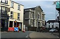
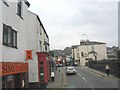
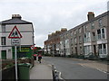
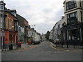
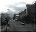
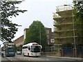
Photos of LL57 2DD


Area Information
Living in LL57 2DD means inhabiting a compact, densely populated residential cluster in north Wales. The area covers just 3.1 hectares, housing 1,295 people in a space where 42,447 individuals live per square kilometre. This small postcode area reflects a community shaped by proximity and shared resources. Daily life here is defined by its proximity to Bangor, a town offering services, employment, and cultural hubs. The area’s youth-centric demographic—median age 22—suggests a dynamic, often student-influenced environment. With limited open space, residents prioritise convenience, relying on nearby amenities and transport links. LL57 2DD is not a sprawling suburb but a tight-knit cluster where community ties are likely strong, though the high density may mean limited private outdoor space. For those seeking a compact, accessible location near a larger town, this postcode offers a blend of practicality and connectivity, albeit with a focus on shared living rather than sprawling development.
- Area Type
- Postcode
- Area Size
- 3.1 hectares
- Population
- 1295
- Population Density
- 2396 people/km²
The property market in LL57 2DD is characterised by a 46% home ownership rate, indicating that nearly half of residents rent their homes. This suggests a rental market that may cater to students, temporary workers, or those employed in Bangor’s local economy. The area’s accommodation type is predominantly houses, which is notable given its small size and high density. This mix implies a blend of single-family homes and possibly smaller detached properties, though the limited area size means housing stock is constrained. Buyers considering LL57 2DD should note that the small postcode area may not offer extensive choice, requiring exploration of nearby zones for more options. The low home ownership rate also means competition for rental properties could be fierce, particularly during academic terms when student demand peaks. For those seeking ownership, the area’s compact nature may necessitate a focus on nearby suburbs for broader selection.
House Prices in LL57 2DD
Showing 1 properties
| Address | Type | Beds | Baths | Last Sale Price | Last Sale Date | |
|---|---|---|---|---|---|---|
| Alun Hostel, Normal College Of Education, College Road, Bangor, LL57 2DD | studentAccommodation | - | - | - | - |
Energy Efficiency in LL57 2DD
The lifestyle in LL57 2DD is shaped by its proximity to retail and transport hubs. Nearby shops include M&S Menai Bangor, Morrisons Bangor, and Asda Bangor, offering everyday essentials and groceries. These stores cater to both residents and shoppers from surrounding areas, ensuring convenience for daily errands. The area’s rail links to Bangor and Llanfairpwll provide access to broader leisure and cultural opportunities, from local cafes to regional attractions. While the data does not mention parks or recreational spaces, the high population density suggests limited private outdoor areas, with communal green spaces potentially shared with nearby zones. The mix of retail and transport options makes daily life practical, though residents may need to venture further for dedicated leisure facilities. The compact nature of the area means amenities are closely clustered, prioritising accessibility over expansiveness.
Amenities
Schools
Near LL57 2DD are two educational institutions: Ysgol Gynradd Hirael and Bangor Centre for Developmental Disabilities. Both are categorised as ‘other’ in the data, which does not specify their exact type or Ofsted ratings. Ysgol Gynradd Hirael may serve as a primary or secondary school, while the Bangor Centre likely provides specialist support for learners with disabilities. The presence of both suggests a range of educational provision, though the lack of detailed information means families must investigate further to confirm suitability. For parents, the mix of school types could indicate a focus on inclusive education, but without specific performance metrics, it is difficult to assess quality. Prospective residents are advised to contact the schools directly for detailed information on curriculum, facilities, and accessibility.
| Rank | School | Type | Entry gender | Ages |
|---|
Explore more schools in this area
Go to Schools tabDemographics
LL57 2DD’s population is overwhelmingly young, with a median age of 22 and 62% of residents aged 15–29. This skew suggests a community influenced by students, recent graduates, or young professionals. Home ownership here is relatively low at 46%, indicating a significant proportion of renters, possibly linked to student accommodation or transient employment patterns. The area’s accommodation is predominantly houses, which is unusual for a small, high-density postcode, hinting at a mix of family homes and smaller dwellings. The predominant ethnic group is White, with no data provided on other demographics. The high population density—42,447 per km²—means living spaces are closely packed, which may impact privacy and access to green space. For families or those seeking long-term stability, the low home ownership rate and youth profile suggest this area may cater more to temporary or short-term needs than to settled communities.
Household Size
Accommodation Type
Tenure
Ethnic Group
Religion
Household Composition
Age
Household Deprivation
NS-SEC
Explore more demographic insights in this area
Go to Demographics tabPlanning
Planning Constraints
- Flood RiskPremium
- Ramsar Wetland SitesPremium
- Area of Outstanding Natural BeautyPremium
- Protected Nature ReservePremium
- Protected WoodlandPremium
- Crime RiskPremium