Area Overview for LL57 1LA
Photos of LL57 1LA
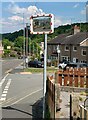

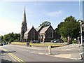
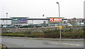
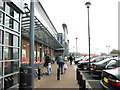
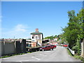
100 photos from this area
Area Information
Key information about the LL57 1LA including its size, population, and administrative classification.
- Area Type
- Postcode
- Area Size
- 3299 m²
- Population
- 1988
- Population Density
- 3744 people/km²
House Prices in LL57 1LA
19
Properties
£80,000
Average Sold Price
£65,000
Lowest Price
£95,000
Highest Price
Showing 19 properties
| Address | Type | Beds | Baths | Last Sale Price | Last Sale Date | |
|---|---|---|---|---|---|---|
| 59 Kyffin Terrace, Bangor, LL57 1LA | Terraced | 2 | 1 | £95,000 | Aug 2020 | |
| First Floor Flat, 60 Kyffin Terrace, Bangor, LL57 1LA | Flat | - | - | £65,000 | Sep 2003 | |
| A, 59 Kyffin Terrace, Bangor, LL57 1LA | Terraced | - | - | - | - | |
| Gwynedd Electrical, Nfo Beauty, 61 Kyffin Terrace, Bangor, LL57 1LA | shop | - | - | - | - | |
| Home Of Heating Ltd, 4-5 Kyffin Terrace, Bangor, LL57 1LA | shop | - | - | - | - | |
| Neuadd Y Castell, Kyffin Terrace, Bangor, LL57 1LA | studentAccommodation | - | - | - | - | |
| First Floor Flat, 61 Kyffin Terrace, Bangor, LL57 1LA | Flat | - | - | - | - | |
| Flat 5, Neuadd Y Castell, Kyffin Terrace, Bangor, LL57 1LA | Flat | - | - | - | - | |
| Flat 1, Neuadd Y Castell, Kyffin Terrace, Bangor, LL57 1LA | Flat | - | - | - | - | |
| Flat 8, Neuadd Y Castell, Kyffin Terrace, Bangor, LL57 1LA | Flat | - | - | - | - |
Page 1 of 2
Energy Efficiency in LL57 1LA
Amenities
Schools
| Rank | School | Type | Entry gender | Ages |
|---|
Explore more schools in this area
Go to Schools tabDemographics
Household Size
One person
most common
Accommodation Type
Houses
most common
Tenure
17
majority
Ethnic Group
White
most common
Religion
N/A
most common
Household Composition
N/A
most common
Age
22
median
Young Adults (15-29 years)
most common
Household Deprivation
N/A
with no deprivation
NS-SEC
8
in Lower managerial occupations
Explore more demographic insights in this area
Go to Demographics tabPlanning
Planning Constraints
- Flood RiskPremium
- Ramsar Wetland SitesPremium
- Area of Outstanding Natural BeautyPremium
- Protected Nature ReservePremium
- Protected WoodlandPremium
- Crime RiskPremium