Area Overview for LL56 4NJ
Photos of LL56 4NJ

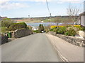
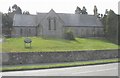


42 photos from this area
Area Information
Key information about the LL56 4NJ including its size, population, and administrative classification.
- Area Type
- Postcode
- Area Size
- 6.4 hectares
- Population
- 2330
- Population Density
- 396 people/km²
House Prices in LL56 4NJ
10
Properties
£225,071
Average Sold Price
£115,000
Lowest Price
£365,000
Highest Price
Showing 10 properties
| Address | Type | Beds | Baths | Last Sale Price | Last Sale Date | |
|---|---|---|---|---|---|---|
| Caswenan, Caernarfon Road, Y Felinheli, LL56 4NJ | Semi-detached | 3 | 3 | £365,000 | Dec 2023 | |
| Trecastell, Caernarfon Road, Y Felinheli, LL56 4NJ | Semi-detached | - | - | £247,000 | Apr 2008 | |
| Hyfrydle, Caernarfon Road, Y Felinheli, LL56 4NJ | Detached | - | - | £330,000 | Nov 2006 | |
| Coed Menai, Caernarfon Road, Y Felinheli, LL56 4NJ | Semi-detached | - | - | £260,000 | Jun 2006 | |
| Cae'r Wylan, Caernarfon Road, Y Felinheli, LL56 4NJ | Semi-detached | - | - | £136,000 | Nov 2003 | |
| Cefn Llwyn, Caernarfon Road, Y Felinheli, LL56 4NJ | Detached | - | - | £122,500 | Jan 2002 | |
| Rhosyr, Caernarfon Road, Y Felinheli, LL56 4NJ | Detached | - | - | £115,000 | Oct 1998 | |
| Cefn Llwyn Bach, Cefn Llwyn, Caernarfon Road, Y Felinheli, LL56 4NJ | Semi-detached | - | - | - | - | |
| Y Gorwel, Caernarfon Road, Y Felinheli, LL56 4NJ | Detached | - | - | - | - | |
| Y Betws, Caernarfon Road, Y Felinheli, LL56 4NJ | house | - | - | - | - |
Energy Efficiency in LL56 4NJ
Amenities
Schools
| Rank | School | Type | Entry gender | Ages |
|---|
Explore more schools in this area
Go to Schools tabDemographics
Household Size
One person
most common
Accommodation Type
Houses
most common
Tenure
69
majority
Ethnic Group
White
most common
Religion
N/A
most common
Household Composition
N/A
most common
Age
47
median
Adults (30-64 years)
most common
Household Deprivation
N/A
with no deprivation
NS-SEC
41
in Lower managerial occupations
Explore more demographic insights in this area
Go to Demographics tabPlanning
Planning Constraints
- Flood RiskPremium
- Ramsar Wetland SitesPremium
- Area of Outstanding Natural BeautyPremium
- Protected Nature ReservePremium
- Protected WoodlandPremium
- Crime RiskPremium