Area Overview for LL55 4NH
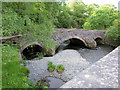
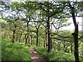
Photos of LL55 4NH


Area Information
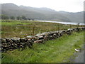
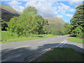
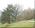
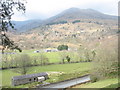
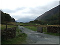
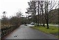
LL55 4NH is a small, low-density residential area in Wales, spanning 9.4 hectares and home to 1196 residents. With a population density of just 12 people per square kilometre, this postcode area feels distinctly quiet and unspoiled. The community here is predominantly middle-aged, with a median age of 47 and most residents falling within the 30-64 age range. This suggests a stable, established population, likely with long-term ties to the area. The housing stock is largely composed of owner-occupied homes, reflecting a sense of permanence. While the area lacks major urban infrastructure, its small size and sparse population create a peaceful, low-traffic environment. Proximity to nearby towns and amenities, such as retail outlets and rail stations, offers practical convenience without the congestion of larger centres. For those seeking a tranquil, family-oriented setting with easy access to surrounding services, LL55 4NH presents a unique blend of seclusion and connectivity.
- Area Type
- Postcode
- Area Size
- 9.4 hectares
- Population
- 1196
- Population Density
- 12 people/km²
The property market in LL55 4NH is characterised by a high rate of home ownership (66%) and a focus on houses rather than flats or apartments. This suggests a community prioritising private, family-oriented living spaces over high-density housing. Given the area’s small size and sparse population, the housing stock is likely limited, with properties spread across the 9.4-hectare postcode. The predominance of owner-occupied homes indicates a market where long-term residency is common, though the exact balance between rental and purchase opportunities is unclear. Buyers should consider that the area’s compact nature may restrict availability, and proximity to nearby towns could be crucial for those seeking more extensive property choices. For those valuing quiet, low-traffic living with a focus on stability, LL55 4NH’s housing profile offers a distinct advantage.
House Prices in LL55 4NH
Showing 1 properties
| Address | Type | Beds | Baths | Last Sale Price | Last Sale Date | |
|---|---|---|---|---|---|---|
| Snowdonia Cottage, A 498 From Bethania To Stryd Gwynant Beddgelert, Beddgelert, LL55 4NH | Detached | - | - | - | - |
Energy Efficiency in LL55 4NH
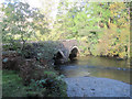
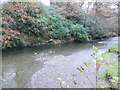
The lifestyle in LL55 4NH is shaped by its proximity to nearby amenities, including five metro stops such as Summit and Nantmor, which offer easy access to local services. Retail options include Morrisons Blaenau and Co-op Blaenau, providing essential shopping needs within reach. The area’s rail stations connect residents to broader regional networks, facilitating commuting or day trips. While the data does not specify parks or leisure facilities, the presence of protected nature reserves and woodlands nearby suggests opportunities for outdoor activities. The combination of practical amenities and natural surroundings creates a balanced environment, blending convenience with the tranquillity of a small, rural postcode.
Amenities
Schools
The nearest school to LL55 4NH is Ysgol Gynradd Beddgelert, which is categorised as an ‘other’ type in the data. While no Ofsted rating is provided, the presence of a single school suggests a limited range of educational options for families. The absence of additional schools, such as primary or secondary institutions, may require residents to travel to nearby towns for broader schooling needs. The school’s type and location imply a focus on local, community-based education, which could be beneficial for families seeking a close-knit environment. However, the lack of multiple schools may pose challenges for those prioritising a variety of educational settings or specialised facilities.
| Rank | School | Type | Entry gender | Ages |
|---|
Explore more schools in this area
Go to Schools tabDemographics
The demographic profile of LL55 4NH is shaped by a median age of 47, with the majority of residents aged between 30 and 64. This indicates a mature, stable community with a strong presence of working-age adults. Home ownership is high, with 66% of residents owning their properties, suggesting a preference for long-term settlement over rental living. The accommodation type is predominantly houses, which aligns with the area’s low density and suburban character. The predominant ethnic group is White, reflecting the broader demographic trends in rural Wales. While no specific data on deprivation is provided, the high home ownership rate and moderate population size imply a relatively self-sufficient community. The absence of significant age or ethnic diversity may appeal to those seeking a cohesive, familiar environment but could also limit the range of cultural or social experiences available.
Household Size
Accommodation Type
Tenure
Ethnic Group
Religion
Household Composition
Age
Household Deprivation
NS-SEC
Explore more demographic insights in this area
Go to Demographics tabPlanning
Planning Constraints
- Flood RiskPremium
- Ramsar Wetland SitesPremium
- Area of Outstanding Natural BeautyPremium
- Protected Nature ReservePremium
- Protected WoodlandPremium
- Crime RiskPremium