Area Overview for LL55 2UT
Photos of LL55 2UT
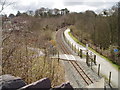
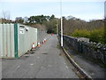
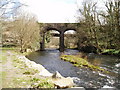
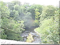
62 photos from this area
Area Information
Key information about the LL55 2UT including its size, population, and administrative classification.
- Area Type
- Postcode
- Area Size
- 1.4 hectares
- Population
- 1597
- Population Density
- 3090 people/km²
House Prices in LL55 2UT
22
Properties
£144,500
Average Sold Price
£56,500
Lowest Price
£260,000
Highest Price
Showing 22 properties
| Address | Type | Beds | Baths | Last Sale Price | Last Sale Date | |
|---|---|---|---|---|---|---|
| 5 Llys Y Garn, Caernarfon, LL55 2UT | house | - | - | £260,000 | Apr 2022 | |
| 3 Llys Y Garn, Caernarfon, LL55 2UT | house | - | - | £178,000 | Feb 2020 | |
| 20 Llys Y Garn, Caernarfon, LL55 2UT | Semi-detached | 3 | - | £171,500 | Nov 2014 | |
| 22 Llys Y Garn, Caernarfon, LL55 2UT | Detached | - | - | £200,000 | Jan 2008 | |
| 9 Llys Y Garn, Caernarfon, LL55 2UT | house | - | - | £162,500 | Sep 2007 | |
| 10 Llys Y Garn, Caernarfon, LL55 2UT | house | - | - | £120,000 | Aug 2005 | |
| 7 Llys Y Garn, Caernarfon, LL55 2UT | Detached | - | - | £95,000 | Apr 2003 | |
| 16 Llys Y Garn, Caernarfon, LL55 2UT | house | - | - | £56,500 | Nov 1999 | |
| 11 Llys Y Garn, Caernarfon, LL55 2UT | Detached | - | - | £57,000 | Apr 1998 | |
| Bro Castell, 6 Llys Y Garn, Caernarfon, LL55 2UT | Detached | 4 | - | - | - |
Page 1 of 3
Energy Efficiency in LL55 2UT
Amenities
Schools
| Rank | School | Type | Entry gender | Ages |
|---|
Explore more schools in this area
Go to Schools tabDemographics
Household Size
Family (3-5 people)
most common
Accommodation Type
Houses
most common
Tenure
73
majority
Ethnic Group
White
most common
Religion
N/A
most common
Household Composition
N/A
most common
Age
47
median
Adults (30-64 years)
most common
Household Deprivation
N/A
with no deprivation
NS-SEC
27
in Lower managerial occupations
Explore more demographic insights in this area
Go to Demographics tabPlanning
Planning Constraints
- Flood RiskPremium
- Ramsar Wetland SitesPremium
- Area of Outstanding Natural BeautyPremium
- Protected Nature ReservePremium
- Protected WoodlandPremium
- Crime RiskPremium