Area Overview for LL55 1EA
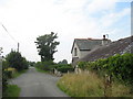
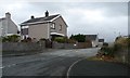
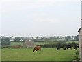
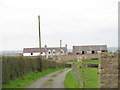
Photos of LL55 1EA
![Ffordd Bethel / Bethel Road [B4366] in LL55 1EA](https://images.propbar.co.uk/images/geograph/47/54/4754724_120.jpg)
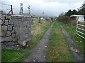
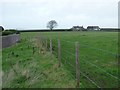

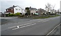
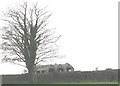
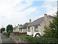
21 photos from this area
Area Information
Key information about the LL55 1EA including its size, population, and administrative classification.
- Area Type
- Postcode
- Area Size
- 3.6 hectares
- Population
- 2114
- Population Density
- 994 people/km²
House Prices in LL55 1EA
15
Properties
£191,773
Average Sold Price
£60,000
Lowest Price
£265,000
Highest Price
Showing 15 properties
| Address | Type | Beds | Baths | Last Sale Price | Last Sale Date | |
|---|---|---|---|---|---|---|
| Y Ddôl, 8 Pengelli Wyn, Caernarfon, LL55 1EA | house | - | - | £260,000 | Feb 2022 | |
| Dashenka, 11 Pengelli Wyn, Caernarfon, LL55 1EA | Bungalow | - | - | £265,000 | Nov 2021 | |
| Arosfa, 12 Pengelli Wyn, Caernarfon, LL55 1EA | Bungalow | - | - | £213,000 | Mar 2021 | |
| Cilgwyn, Pengelli Wyn, Caernarfon, LL55 1EA | house | - | - | £185,000 | Jul 2018 | |
| Y Gelli, 13 Pengelli Wyn, Caernarfon, LL55 1EA | Bungalow | 3 | 1 | £215,000 | Jan 2018 | |
| Wenallt, 1 Pengelli Wyn, Caernarfon, LL55 1EA | Detached | 3 | - | £180,000 | Dec 2016 | |
| Rhandir, 9 Pengelli Wyn, Caernarfon, LL55 1EA | Bungalow | - | - | £236,000 | Aug 2015 | |
| Y Betws, 10 Pengelli Wyn, Caernarfon, LL55 1EA | Bungalow | - | - | £200,000 | Jun 2015 | |
| Rhiwlas, 4 Pengelli Wyn, Caernarfon, LL55 1EA | Bungalow | - | - | £220,000 | Jan 2012 | |
| Frondeg, 7 Pengelli Wyn, Caernarfon, LL55 1EA | Bungalow | 4 | - | £75,500 | May 2000 |
Page 1 of 2
Energy Efficiency in LL55 1EA
Amenities
Schools
| Rank | School | Type | Entry gender | Ages |
|---|
Explore more schools in this area
Go to Schools tabDemographics
Household Size
One person
most common
Accommodation Type
Houses
most common
Tenure
50
majority
Ethnic Group
White
most common
Religion
N/A
most common
Household Composition
N/A
most common
Age
47
median
Adults (30-64 years)
most common
Household Deprivation
N/A
with no deprivation
NS-SEC
23
in Lower managerial occupations
Explore more demographic insights in this area
Go to Demographics tabPlanning
Planning Constraints
- Flood RiskPremium
- Ramsar Wetland SitesPremium
- Area of Outstanding Natural BeautyPremium
- Protected Nature ReservePremium
- Protected WoodlandPremium
- Crime RiskPremium