Area Overview for LL54 6PB
Photos of LL54 6PB
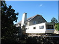
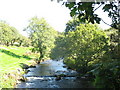
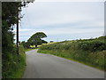
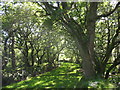
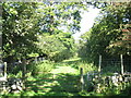
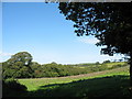
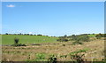
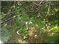
8 photos from this area
Area Information
Key information about the LL54 6PB including its size, population, and administrative classification.
- Area Type
- Postcode
- Area Size
- 1.3 km²
- Population
- 1793
- Population Density
- 246 people/km²
House Prices in LL54 6PB
12
Properties
£243,200
Average Sold Price
£16,000
Lowest Price
£475,000
Highest Price
Showing 12 properties
| Address | Type | Beds | Baths | Last Sale Price | Last Sale Date | |
|---|---|---|---|---|---|---|
| EITHINOG GANOL, FFORDD CLYNNOG, Penygroes, LL54 6PB | Detached | - | - | £420,000 | Sep 2018 | |
| The Woollen Mill, Ffordd Clynnog, Penygroes, LL54 6PB | Flat | - | - | £475,000 | Jan 2018 | |
| Glanrafon Bach, Ffordd Clynnog, Penygroes, LL54 6PB | Detached | - | - | £265,000 | Apr 2006 | |
| Cae Efa Lwyd Fach, Ffordd Clynnog, Penygroes, LL54 6PB | Detached | - | - | £40,000 | Mar 2002 | |
| Cae Efa Lwyd Fawr, Ffordd Clynnog, Penygroes, LL54 6PB | Detached | - | - | £16,000 | Jul 1998 | |
| 2, Bryn Hwylfa, Road From Junction South Of Cae Efa Lwyd Fawr Passing Cae Efa Lwyd Fach To Junction Near Pen Lan, Penygroes, LL54 6PB | Cottage | 2 | 1 | - | - | |
| STABL EITHINOG, FFORDD CLYNNOG, Penygroes, LL54 6PB | Detached | - | - | - | - | |
| Ysgubor, Cae Efa Lwyd Fawr, Ffordd Clynnog, Penygroes, LL54 6PB | Detached | - | - | - | - | |
| Snowden At The Woolen Mill, Ffordd Clynnog, Penygroes, LL54 6PB | Flat | - | - | - | - | |
| 4, Ceulan, Bryn Hwylfa, Road From Junction South Of Cae Efa Lwyd Fawr Passing Cae Efa Lwyd Fach To Junction Near Pen Lan, Penygroes, LL54 6PB | Terraced | - | - | - | - |
Page 1 of 2
Energy Efficiency in LL54 6PB
Amenities
Schools
| Rank | School | Type | Entry gender | Ages |
|---|
Explore more schools in this area
Go to Schools tabDemographics
Household Size
One person
most common
Accommodation Type
Houses
most common
Tenure
63
majority
Ethnic Group
White
most common
Religion
N/A
most common
Household Composition
N/A
most common
Age
47
median
Adults (30-64 years)
most common
Household Deprivation
N/A
with no deprivation
NS-SEC
25
in Lower managerial occupations
Explore more demographic insights in this area
Go to Demographics tabPlanning
Planning Constraints
- Flood RiskPremium
- Ramsar Wetland SitesPremium
- Area of Outstanding Natural BeautyPremium
- Protected Nature ReservePremium
- Protected WoodlandPremium
- Crime RiskPremium