Area Overview for LL54 6LW
Photos of LL54 6LW
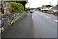
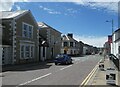
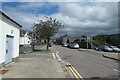
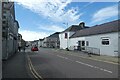
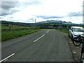
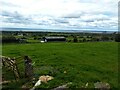
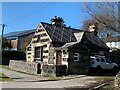
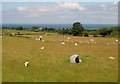
68 photos from this area
Area Information
Key information about the LL54 6LW including its size, population, and administrative classification.
- Area Type
- Postcode
- Area Size
- 1653 m²
- Population
- 1793
- Population Density
- 246 people/km²
House Prices in LL54 6LW
10
Properties
£145,000
Average Sold Price
£145,000
Lowest Price
£145,000
Highest Price
Showing 10 properties
| Address | Type | Beds | Baths | Last Sale Price | Last Sale Date | |
|---|---|---|---|---|---|---|
| Cymru Fudd, Water Street, Penygroes, LL54 6LW | Terraced | 3 | 2 | £145,000 | Jun 2021 | |
| 47 Water Street, Penygroes, LL54 6LW | house | 3 | - | - | - | |
| Ground Floor Flat, Cymru Fudd, Water Street, Penygroes, LL54 6LW | Flat | - | - | - | - | |
| Office No 6, Tŷ Iorwerth, 39-41 Water Street, Penygroes, LL54 6LW | Office | - | - | - | - | |
| First Floor, Tŷ Iorwerth, 39-41 Water Street, Penygroes, LL54 6LW | Office | - | - | - | - | |
| Yr Hen Bost, 43-45 Water Street, Penygroes, LL54 6LW | house | - | - | - | - | |
| Swyddfa'r Post Cyf, Post Office, Water Street, Penygroes, LL54 6LW | shop | - | - | - | - | |
| 49 Water Street, Penygroes, LL54 6LW | Terraced | - | - | - | - | |
| Office 8, Tŷ Iorwerth, 39-41 Water Street, Penygroes, LL54 6LW | Office | - | - | - | - | |
| Atm, Tŷ Iorwerth, 39-41 Water Street, Penygroes, LL54 6LW | Retail | - | - | - | - |
Energy Efficiency in LL54 6LW
Amenities
Schools
| Rank | School | Type | Entry gender | Ages |
|---|
Explore more schools in this area
Go to Schools tabDemographics
Household Size
One person
most common
Accommodation Type
Houses
most common
Tenure
63
majority
Ethnic Group
White
most common
Religion
N/A
most common
Household Composition
N/A
most common
Age
47
median
Adults (30-64 years)
most common
Household Deprivation
N/A
with no deprivation
NS-SEC
25
in Lower managerial occupations
Explore more demographic insights in this area
Go to Demographics tabPlanning
Planning Constraints
- Flood RiskPremium
- Ramsar Wetland SitesPremium
- Area of Outstanding Natural BeautyPremium
- Protected Nature ReservePremium
- Protected WoodlandPremium
- Crime RiskPremium