Area Overview for LL54 5UP
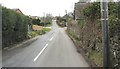
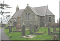
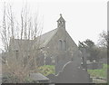
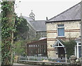
Photos of LL54 5UP
Area Information
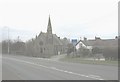
Living in LL54 5UP means being part of a small, tightly knit residential cluster in north Wales. With a population of 2082 spread over 1.3 hectares, the area has a low density of 132 people per square kilometre, offering a quiet, community-focused environment. The median age of 47 suggests a mature demographic, with the majority of residents aged between 30 and 64. This is a place where homes are predominantly owner-occupied, with 80% of properties owned by their residents. The area’s compact size means amenities and services are within practical reach, though it remains a small, specialised postcode with limited expansion. Daily life here is shaped by proximity to local schools, retail outlets, and transport links, making it suitable for those prioritising convenience over sprawling urban settings. The absence of major planning constraints like protected woodlands or AONB designations means development is less restricted, though flood risk remains a notable consideration. For buyers seeking a stable, low-density community with a focus on family living, LL54 5UP offers a distinct blend of practicality and local character.
- Area Type
- Postcode
- Area Size
- 1.3 hectares
- Population
- 2082
- Population Density
- 132 people/km²
The property market in LL54 5UP is characterised by high home ownership (80%) and a focus on houses rather than flats or apartments. This suggests a market skewed towards owner-occupied homes, likely appealing to families and long-term residents. The area’s small size—just 1.3 hectares—means the housing stock is limited, with no indication of significant rental properties or new developments. Buyers should consider the proximity to nearby amenities, such as schools and retail, which are within practical reach. The compact nature of the area may also mean that properties are highly sought after, with limited scope for expansion or subdivision. For those prioritising a stable, low-density community with established housing, LL54 5UP offers a niche market. However, the lack of major transport hubs or urban infrastructure means it is more suited to those valuing tranquillity over accessibility to larger cities.
House Prices in LL54 5UP
Showing 1 properties
| Address | Type | Beds | Baths | Last Sale Price | Last Sale Date | |
|---|---|---|---|---|---|---|
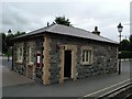
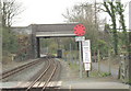
| Dinas Station, Road From Tyn Llan Dinas To A 4871, Dinas, Caernarfon, LL54 5UP | commercial | - | - | - | - |
Energy Efficiency in LL54 5UP
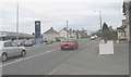
The lifestyle in LL54 5UP is shaped by its proximity to practical amenities. Residents have access to five retail outlets, including Morrisons Daily, Tesco Caernarfon, and Spar, providing essential shopping and daily necessities. Four metro stations—Dinas, Caernarfon, and Waunfawr—offer connectivity to nearby towns and services, while Caernarfon Airport provides an additional transport option for travel. Though the area lacks detailed information on parks or leisure facilities, the presence of multiple retail and transport hubs suggests a community focused on convenience and accessibility. The combination of local shops, transport links, and nearby schools creates a self-contained environment, ideal for those seeking a balance between rural tranquillity and urban connectivity.
Amenities
Schools
Residents of LL54 5UP have access to three schools within the vicinity: Ysgol Gynradd Felinwnda, Ysgol Gynradd Rhosgadfan, and Y.G. Rhostryfan. All are categorised as 'other' in the data, though no Ofsted ratings or specific educational focus are provided. The presence of multiple schools suggests a range of educational options for families, though the exact quality or curriculum of these institutions is not detailed. The mix of school types—while not specified—may indicate a combination of primary, secondary, or specialist provision. For parents seeking proximity to educational facilities, the availability of three schools within practical reach is a practical advantage. However, without further data on performance or facilities, prospective buyers must rely on local reputation or direct visits to assess suitability for their children’s needs.
| Rank | School | Type | Entry gender | Ages |
|---|
Explore more schools in this area
Go to Schools tabDemographics
The community in LL54 5UP is defined by its adult population, with the most common age range being 30–64 years. The median age of 47 reflects a mature demographic, suggesting a stable, long-term resident base. Home ownership is high at 80%, indicating a preference for private property over rentals, which is typical of smaller rural or semi-rural areas. The accommodation type is predominantly houses, not flats, aligning with the area’s low density and traditional housing stock. The predominant ethnic group is White, though no further breakdown of diversity is provided. With 2082 residents spread over 1.3 hectares, the population density of 132 people per square kilometre is low, contributing to a more spacious, less congested living environment. This density also means fewer shared spaces and a stronger sense of individual property ownership. The data does not include specific deprivation metrics, but the high home ownership rate and stable age profile suggest a community with relatively consistent economic and social conditions.
Household Size
Accommodation Type
Tenure
Ethnic Group
Religion
Household Composition
Age
Household Deprivation
NS-SEC
Explore more demographic insights in this area
Go to Demographics tabPlanning
Planning Constraints
- Flood RiskPremium
- Ramsar Wetland SitesPremium
- Area of Outstanding Natural BeautyPremium
- Protected Nature ReservePremium
- Protected WoodlandPremium
- Crime RiskPremium