Area Overview for LL54 5LU
Photos of LL54 5LU
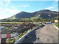
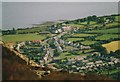
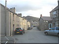
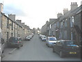
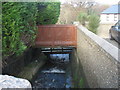
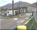
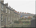
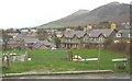
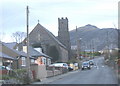
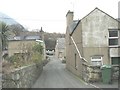
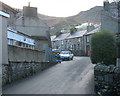
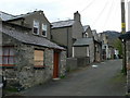
100 photos from this area
Area Information
Key information about the LL54 5LU including its size, population, and administrative classification.
- Area Type
- Postcode
- Area Size
- 3.5 hectares
- Population
- 1557
- Population Density
- 32 people/km²
House Prices in LL54 5LU
18
Properties
£354,000
Average Sold Price
£350,000
Lowest Price
£358,000
Highest Price
Showing 18 properties
| Address | Type | Beds | Baths | Last Sale Price | Last Sale Date | |
|---|---|---|---|---|---|---|
| Cae Croppa, Road From Angorfa Southwestwards Passing Cae Cropa And Fron Oleu, Trefor, LL54 5LU | Detached | 2 | - | £350,000 | Oct 2024 | |
| Gwyndre, Road From Angorfa Southwestwards Passing Cae Cropa And Fron Oleu, Trefor, LL54 5LU | Detached | 3 | 2 | £358,000 | Sep 2023 | |
| 7 Hen Ysgol, Trefor, LL54 5LU | Flat | - | - | - | - | |
| Fron Dirion, Road From Angorfa Southwestwards Passing Cae Cropa And Fron Oleu, Trefor, LL54 5LU | house | - | - | - | - | |
| 8 Hen Ysgol, Trefor, LL54 5LU | Bungalow | - | - | - | - | |
| Haulfryn, Road From Angorfa Southwestwards Passing Cae Cropa And Fron Oleu, Trefor, LL54 5LU | Bungalow | - | - | - | - | |
| Llys Gwilym, Road From Angorfa Southwestwards Passing Cae Cropa And Fron Oleu, Trefor, LL54 5LU | Semi-detached | - | - | - | - | |
| Angorfa, Road From Angorfa Southwestwards Passing Cae Cropa And Fron Oleu, Trefor, LL54 5LU | Semi-detached | - | - | - | - | |
| 3 Hen Ysgol, Trefor, LL54 5LU | Bungalow | - | - | - | - | |
| 6 Hen Ysgol, Trefor, LL54 5LU | Flat | - | - | - | - |
Page 1 of 2
Energy Efficiency in LL54 5LU
Amenities
Schools
| Rank | School | Type | Entry gender | Ages |
|---|
Explore more schools in this area
Go to Schools tabDemographics
Household Size
Two person
most common
Accommodation Type
Houses
most common
Tenure
73
majority
Ethnic Group
White
most common
Religion
N/A
most common
Household Composition
N/A
most common
Age
47
median
Adults (30-64 years)
most common
Household Deprivation
N/A
with no deprivation
NS-SEC
27
in Lower managerial occupations
Explore more demographic insights in this area
Go to Demographics tabPlanning
Planning Constraints
- Flood RiskPremium
- Ramsar Wetland SitesPremium
- Area of Outstanding Natural BeautyPremium
- Protected Nature ReservePremium
- Protected WoodlandPremium
- Crime RiskPremium