Area Overview for LL53 6YL
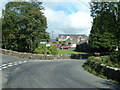
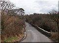
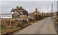
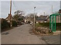
Photos of LL53 6YL


Area Information
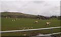
Living in LL53 6YL means inhabiting a small, residential postcode area in Wales, home to 1,920 people spread across 32 people per square kilometre. This is a tightly knit community, with homes predominantly in the form of houses rather than flats, reflecting a quiet, low-density lifestyle. The area’s compact size means residents are likely to know their neighbours, with daily life shaped by proximity to local amenities and natural surroundings. While the data does not specify the presence of major landmarks, the area’s small footprint suggests a focus on simplicity and ease of access to nearby services. The median age of 47 indicates a population skewed towards adults aged 30–64, suggesting a stable, established community. For buyers, LL53 6YL offers a chance to settle in a place where the pace of life is slower, and the residential character is defined by traditional housing stock. Its location, while not urban, is likely to be within reach of larger towns, balancing seclusion with connectivity.
- Area Type
- Postcode
- Area Size
- Not available
- Population
- 1920
- Population Density
- 32 people/km²
LL53 6YL is a predominantly owner-occupied area, with 75% of residents in house ownership. The accommodation type is exclusively houses, which is unusual for a small postcode area but suggests a focus on single-family homes rather than apartments or shared housing. This makes the property market here distinct, with limited availability of rental properties and a strong emphasis on private ownership. The small size of the area means the housing stock is likely to be tightly clustered, with homes spaced apart to accommodate the low population density. For buyers, this presents a niche opportunity: a chance to purchase in a quiet, established residential cluster where the primary housing type is houses. The market may be competitive due to the area’s limited size, but the absence of planning constraints or environmental restrictions (such as AONB or protected woodlands) could make it attractive for those seeking a traditional, low-maintenance home.
House Prices in LL53 6YL
No properties found in this postcode.
Energy Efficiency in LL53 6YL
Daily life in LL53 6YL is shaped by its proximity to practical amenities. The four rail stations—Abererch, Penychain, and Pwllheli—provide access to regional travel, while local retail options like Spar and Asda Pwllheli cater to everyday shopping needs. Though the area lacks large commercial centres, these venues offer essentials such as groceries and basic services. The absence of detailed data on leisure or dining options means the character of the area’s lifestyle is inferred from its residential focus and low population density. Residents may find the environment conducive to a relaxed pace of life, with limited demand for high-end amenities. The practical reach of these amenities suggests a community that values accessibility over extravagance, with daily routines centred around local services and nearby natural spaces.
Amenities
Schools
Residents of LL53 6YL have access to four schools within practical reach: Ysgol Treferthyr, Ysgol Gynradd Chwilog, Ysgol Gynradd Llangybi, and Ysgol Llanystumdwy. All are categorised as 'other' in the data, though specific types such as primary or secondary are not detailed. The presence of multiple schools suggests a range of educational options, though without Ofsted ratings or specific curricular information, it is difficult to assess their quality. Families may benefit from the proximity of these institutions, which could reduce commuting times for parents. However, the lack of explicit data on school performance means prospective buyers should conduct further research into each institution’s reputation and facilities. The mix of school types, if assumed to include both primary and secondary levels, could provide a continuum of education for children living in the area.
| Rank | School | Type | Entry gender | Ages |
|---|
Explore more schools in this area
Go to Schools tabDemographics
The population of LL53 6YL is predominantly adults, with 30–64 years being the most common age range. The median age of 47 suggests a mature demographic, with 75% of residents owning their homes. This high home ownership rate, combined with the prevalence of houses over flats, indicates a community rooted in long-term residency rather than transient rental tenancies. The predominant ethnic group is White, though no specific data on diversity or deprivation is provided. The low population density of 32 people per square kilometre implies spacious living conditions, with homes likely to have larger gardens or outdoor spaces. This demographic profile suggests a stable, family-oriented environment, with fewer young children or elderly residents compared to areas with higher turnover. The absence of specific data on deprivation means the quality of life can be inferred from the area’s amenities and safety assessments, which are largely positive.
Household Size
Accommodation Type
Tenure
Ethnic Group
Religion
Household Composition
Age
Household Deprivation
NS-SEC
Explore more demographic insights in this area
Go to Demographics tabPlanning
Planning Constraints
- Flood RiskPremium
- Ramsar Wetland SitesPremium
- Area of Outstanding Natural BeautyPremium
- Protected Nature ReservePremium
- Protected WoodlandPremium
- Crime RiskPremium