Area Overview for LL53 5YY
Photos of LL53 5YY
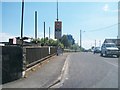
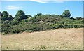
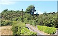
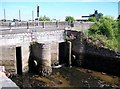


92 photos from this area
Area Information
Key information about the LL53 5YY including its size, population, and administrative classification.
- Area Type
- Postcode
- Area Size
- 29.2 hectares
- Population
- 2087
- Population Density
- 542 people/km²
House Prices in LL53 5YY
32
Properties
£132,157
Average Sold Price
£34,500
Lowest Price
£310,000
Highest Price
Showing 32 properties
| Address | Type | Beds | Baths | Last Sale Price | Last Sale Date | |
|---|---|---|---|---|---|---|
| Tyddyn Iws, Abererch Road, Pwllheli, LL53 5YY | Bungalow | 3 | 1 | £124,500 | Mar 2025 | |
| Tŷ Glaslyn, 45 Abererch Road, Pwllheli, LL53 5YY | Cottage | 2 | 1 | £185,000 | Feb 2025 | |
| 56 Abererch Road, Pwllheli, LL53 5YY | Terraced | 2 | 1 | £165,000 | Dec 2023 | |
| 57 Abererch Road, Pwllheli, LL53 5YY | Terraced | 2 | 1 | £150,000 | Jun 2023 | |
| Gwynfa, Abererch Road, Pwllheli, LL53 5YY | house | - | - | £310,000 | Feb 2022 | |
| 50 Abererch Road, Pwllheli, LL53 5YY | house | - | - | £165,000 | Jul 2021 | |
| Tan Y Rhedyn, Lon Nant Stigallt, Pwllheli, LL53 5YY | Detached | 4 | - | £250,000 | Jun 2021 | |
| 37 Abererch Road, Pwllheli, LL53 5YY | Terraced | 2 | 1 | £167,000 | Jul 2020 | |
| 52 Abererch Road, Pwllheli, LL53 5YY | Terraced | 2 | 1 | £145,000 | Nov 2017 | |
| 43 Abererch Road, Pwllheli, LL53 5YY | Semi-detached | - | - | £130,000 | Aug 2016 |
Page 1 of 4
Energy Efficiency in LL53 5YY
Amenities
Schools
| Rank | School | Type | Entry gender | Ages |
|---|
Explore more schools in this area
Go to Schools tabDemographics
Household Size
One person
most common
Accommodation Type
Houses
most common
Tenure
54
majority
Ethnic Group
White
most common
Religion
N/A
most common
Household Composition
N/A
most common
Age
47
median
Adults (30-64 years)
most common
Household Deprivation
N/A
with no deprivation
NS-SEC
24
in Lower managerial occupations
Explore more demographic insights in this area
Go to Demographics tabPlanning
Planning Constraints
- Flood RiskPremium
- Ramsar Wetland SitesPremium
- Area of Outstanding Natural BeautyPremium
- Protected Nature ReservePremium
- Protected WoodlandPremium
- Crime RiskPremium