Area Overview for LL53 5WH
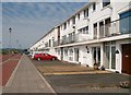
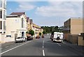
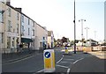
Photos of LL53 5WH

Area Information
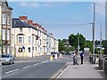
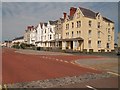
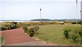
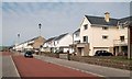
Living in LL53 5WH means being part of a small, tightly knit residential cluster in north Wales. With a population of 2,087 people spread over a compact area, this postcode is characterised by a moderate population density of 542 people per square kilometre. The area is primarily composed of houses, reflecting a community that values traditional living spaces. Residents here are predominantly adults aged 30–64, with a median age of 47, suggesting a stable, mature demographic. Daily life in LL53 5WH balances quiet rural living with proximity to essential services. The area’s modest size means neighbours are likely to know one another, fostering a sense of familiarity. While it lacks the vibrancy of larger towns, its simplicity and low population density make it appealing for those seeking a peaceful, low-stress environment. The absence of major planning constraints or environmental restrictions adds to its practicality, allowing for straightforward development and living. For buyers prioritising space, safety, and a close-knit community, LL53 5WH offers a straightforward, no-frills alternative to more densely populated regions.
- Area Type
- Postcode
- Area Size
- Not available
- Population
- 2087
- Population Density
- 542 people/km²
The property market in LL53 5WH is defined by a 54% home ownership rate, with houses being the predominant accommodation type. This indicates a community where property is largely owner-occupied rather than rental-focused, which can stabilise local housing values and reduce turnover. The presence of houses, rather than flats or apartments, suggests a preference for single-family homes, likely catering to families or individuals seeking space and privacy. Given the area’s small size and low population density, the housing stock is likely limited in scale, with properties spaced apart to accommodate the modest population. Buyers considering LL53 5WH should expect a market that prioritises traditional living over modern developments. The lack of planning constraints or environmental restrictions may make it easier to purchase or renovate properties without bureaucratic hurdles. However, the area’s small size means the immediate surroundings offer few alternatives, so buyers must evaluate whether the available homes meet their specific needs.
House Prices in LL53 5WH
No properties found in this postcode.
Energy Efficiency in LL53 5WH
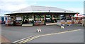
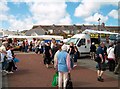
Residents of LL53 5WH have access to a range of nearby amenities that support daily living. Within practical reach are five retail outlets, including Lidl Pwllheli, Iceland Pwllheli, and Spar Store Y, providing essential shopping options. The area’s three railway stations—Pwllheli, Abererch, and Penychain—offer convenient transport links to nearby towns and services. While the postcode itself is small, the surrounding region likely includes additional facilities such as parks, healthcare centres, and community hubs, though these are not explicitly named in the data. The presence of multiple retail and rail options suggests a balance between convenience and the quiet nature of rural living. For those who enjoy local markets or casual dining, the named stores indicate a basic but functional retail environment. The area’s character is defined by its accessibility to essential services without the congestion of larger urban centres, making it suitable for those who value simplicity and practicality in their lifestyle.
Amenities
Schools
| Rank | School | Type | Entry gender | Ages |
|---|
Explore more schools in this area
Go to Schools tabDemographics
The community in LL53 5WH is predominantly composed of adults aged 30–64, with a median age of 47. This suggests a mature, stable population, likely with established careers and family structures. Home ownership rates stand at 54%, indicating a mix of owner-occupied properties and rental homes. The area is largely composed of houses, which aligns with the demographic’s preference for family-friendly living spaces. The predominant ethnic group is White, reflecting the broader trends in rural Wales. While no specific deprivation data is provided, the low population density and absence of environmental constraints suggest a relatively self-sufficient community. The age profile and home ownership figures imply a population that is neither overly young nor transient, which can contribute to a consistent local economy and social fabric. However, the lack of diversity in age and ethnicity may limit the range of cultural or social activities available.
Household Size
Accommodation Type
Tenure
Ethnic Group
Religion
Household Composition
Age
Household Deprivation
NS-SEC
Explore more demographic insights in this area
Go to Demographics tabPlanning
Planning Constraints
- Flood RiskPremium
- Ramsar Wetland SitesPremium
- Area of Outstanding Natural BeautyPremium
- Protected Nature ReservePremium
- Protected WoodlandPremium
- Crime RiskPremium