Area Overview for LL49 9SP
Photos of LL49 9SP
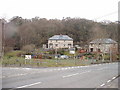
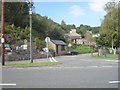
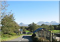
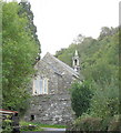
40 photos from this area
Area Information
Key information about the LL49 9SP including its size, population, and administrative classification.
- Area Type
- Postcode
- Area Size
- 20.8 hectares
- Population
- 1196
- Population Density
- 12 people/km²
House Prices in LL49 9SP
10
Properties
£210,500
Average Sold Price
£136,000
Lowest Price
£285,000
Highest Price
Showing 10 properties
| Address | Type | Beds | Baths | Last Sale Price | Last Sale Date | |
|---|---|---|---|---|---|---|
| 3 Bryn Ffynnon, Prenteg, LL49 9SP | Semi-detached | 3 | - | £136,000 | Oct 2020 | |
| Tŷ Glaslyn, A 498 From B 4410 Junction Passing The Glaslyn Hotel To Prenteg, Prenteg, LL49 9SP | Detached | 5 | 1 | £285,000 | Jul 2018 | |
| Tŷ Capel Bethlehem, A 498 From B 4410 Junction Passing The Glaslyn Hotel To Prenteg, Prenteg, LL49 9SP | house | - | - | - | - | |
| Dolwar, A 498 From B 4410 Junction Passing The Glaslyn Hotel To Prenteg, Prenteg, LL49 9SP | Detached | - | - | - | - | |
| Tŷ Newydd, A 498 From B 4410 Junction Passing The Glaslyn Hotel To Prenteg, Prenteg, LL49 9SP | Detached | - | - | - | - | |
| Bryn Glas, A 498 From B 4410 Junction Passing The Glaslyn Hotel To Prenteg, Prenteg, LL49 9SP | house | - | - | - | - | |
| 1 Bryn Ffynnon, Prenteg, LL49 9SP | house | - | - | - | - | |
| 2 Bryn Ffynnon, Prenteg, LL49 9SP | house | - | - | - | - | |
| 4 Bryn Ffynnon, Prenteg, LL49 9SP | house | - | - | - | - | |
| B G G W Visitor Centre, Road From London Terrace To St Johns Church, Prenteg, LL49 9SP | shop | - | - | - | - |
Energy Efficiency in LL49 9SP
Amenities
Schools
| Rank | School | Type | Entry gender | Ages |
|---|
Explore more schools in this area
Go to Schools tabDemographics
Household Size
One person
most common
Accommodation Type
Houses
most common
Tenure
66
majority
Ethnic Group
White
most common
Religion
N/A
most common
Household Composition
N/A
most common
Age
47
median
Adults (30-64 years)
most common
Household Deprivation
N/A
with no deprivation
NS-SEC
28
in Lower managerial occupations
Explore more demographic insights in this area
Go to Demographics tabPlanning
Planning Constraints
- Flood RiskPremium
- Ramsar Wetland SitesPremium
- Area of Outstanding Natural BeautyPremium
- Protected WoodlandPremium
- Crime RiskPremium