Area Overview for LL49 9PP
Photos of LL49 9PP
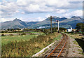
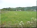
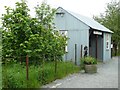
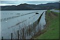
95 photos from this area
Area Information
Key information about the LL49 9PP including its size, population, and administrative classification.
- Area Type
- Postcode
- Area Size
- 2.1 km²
- Population
- 1729
- Population Density
- 382 people/km²
House Prices in LL49 9PP
15
Properties
£470,000
Average Sold Price
£470,000
Lowest Price
£470,000
Highest Price
Showing 15 properties
| Address | Type | Beds | Baths | Last Sale Price | Last Sale Date | |
|---|---|---|---|---|---|---|
| Gwynfryn, Ffordd Glanrafon, Porthmadog, LL49 9PP | house | 4 | 2 | £470,000 | Jan 2025 | |
| Talar Wen, Ffordd Glanrafon, Porthmadog, LL49 9PP | Detached | - | - | - | - | |
| Madog Signs & Blinds, Gwynfryn, Ffordd Glanrafon, Porthmadog, LL49 9PP | shop | - | - | - | - | |
| Fferm Glanrafon, Ffordd Glanrafon, Porthmadog, LL49 9PP | Detached | - | - | - | - | |
| Cambrian Homes, Cambrian Coast Caravans, Ffordd Glanrafon, Porthmadog, LL49 9PP | Leisure | - | - | - | - | |
| Traeth Mawr, Lon Y Traeth, Porthmadog, LL49 9PP | Detached | - | - | - | - | |
| Gwern Eithin, Ffordd Glanrafon, Porthmadog, LL49 9PP | Detached | - | - | - | - | |
| Cynfal, Ffordd Glanrafon, Porthmadog, LL49 9PP | Bungalow | - | - | - | - | |
| Fferm Penmount, Ffordd Glanrafon, Porthmadog, LL49 9PP | Detached | - | - | - | - | |
| Fferm Farm Yard, Ffordd Glanrafon, Porthmadog, LL49 9PP | Detached | - | - | - | - |
Page 1 of 2
Energy Efficiency in LL49 9PP
Amenities
Schools
| Rank | School | Type | Entry gender | Ages |
|---|
Explore more schools in this area
Go to Schools tabDemographics
Household Size
One person
most common
Accommodation Type
Houses
most common
Tenure
62
majority
Ethnic Group
White
most common
Religion
N/A
most common
Household Composition
N/A
most common
Age
47
median
Adults (30-64 years)
most common
Household Deprivation
N/A
with no deprivation
NS-SEC
21
in Lower managerial occupations
Explore more demographic insights in this area
Go to Demographics tabPlanning
Planning Constraints
- Flood RiskPremium
- Ramsar Wetland SitesPremium
- Area of Outstanding Natural BeautyPremium
- Protected Nature ReservePremium
- Protected WoodlandPremium
- Crime RiskPremium