Area Overview for LL48 6NU
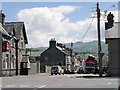
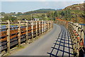
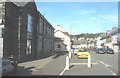
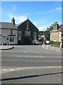
Photos of LL48 6NU


Area Information
Living in LL48 6NU means being part of a small, tightly knit residential cluster in Wales, where the population of 1,368 people is spread across a density of 205 people per square kilometre. This postcode area is characterised by its compact size, making it a quiet, low-density neighbourhood ideal for those seeking a slower pace of life. The community here is predominantly composed of adults aged 30–64, with a median age of 47, suggesting a mature, stable population. Daily life is shaped by proximity to local amenities, including retail stores like Spar and Tesco Porthmadog, and access to rail services such as Penrhyndeudraeth and Llandecwyn stations. The area’s small footprint means residents are likely to know their neighbours, fostering a sense of familiarity. While the postcode lacks major urban infrastructure, its charm lies in its simplicity—a place where practicality and quietude prevail. For buyers seeking a modest, community-focused environment, LL48 6NU offers a snapshot of rural Welsh living, with homes primarily in private ownership and a focus on traditional housing stock.
- Area Type
- Postcode
- Area Size
- Not available
- Population
- 1368
- Population Density
- 205 people/km²
The property market in LL48 6NU is defined by its small scale and focus on owner-occupied homes. With 71% of properties in private ownership, the area is not a rental hotspot but rather a place where residents invest in long-term housing. The predominant accommodation type is houses, which aligns with the community’s demographic profile of middle-aged adults and families. This suggests a market where buyers seek practical, family-sized homes rather than high-value properties. Given the postcode’s compact nature, the housing stock is likely limited to traditional, modest dwellings, with little scope for large-scale development. For buyers, this means a niche market where properties are scarce but may offer strong community ties. However, the lack of major urban amenities or transport links could limit appeal for those prioritising convenience over rural tranquillity.
House Prices in LL48 6NU
No properties found in this postcode.
Energy Efficiency in LL48 6NU
Residents of LL48 6NU have access to a selection of local amenities that cater to daily needs. Retail options include multiple Spar stores and Tesco Porthmadog, ensuring basic shopping is within reach. The area’s rail stations—Penrhyndeudraeth, Llandecwyn, and Minffordd—offer connections to nearby towns, while nearby metro stops like Penrhyn, Pont Croesor, and Nantmor provide additional transport links. Though the data does not specify parks or leisure facilities, the presence of multiple rail and metro stations suggests the area is positioned for easy access to recreational opportunities in surrounding regions. The modest scale of amenities reflects the postcode’s rural character, where convenience is balanced with a focus on simplicity and community.
Amenities
Schools
The nearest school to LL48 6NU is Ysgol Cefn Coch, which is categorised as an ‘other’ type in the data. No Ofsted rating is provided, so its educational standards remain unspecified. The absence of additional schools in the data means families relying on local education may need to consider commuting to nearby areas for secondary schooling. The single school listed suggests limited options for parents, though the proximity to rail stations like Penrhyndeudraeth and Llandecwyn could ease travel to larger educational hubs. For families prioritising a range of school types, LL48 6NU may require careful planning to ensure access to comprehensive education, particularly for older children.
| Rank | School | Type | Entry gender | Ages |
|---|
Explore more schools in this area
Go to Schools tabDemographics
The demographic profile of LL48 6NU reflects a mature, predominantly White population, with 71% of homes owned by residents rather than rented. The median age of 47 indicates a community skewed towards middle-aged adults, with the most common age range being 30–64. This suggests a stable population with established careers and families, likely contributing to the area’s low turnover of residents. The high home ownership rate of 71% underscores a preference for long-term residency over rental properties, which is typical of smaller, rural postcodes. The accommodation type is primarily houses, aligning with the demographic’s need for family-friendly living spaces. While no specific data on deprivation is provided, the lack of significant planning constraints and the presence of basic amenities suggest a moderate quality of life, though limited by the area’s small size and sparse infrastructure.
Household Size
Accommodation Type
Tenure
Ethnic Group
Religion
Household Composition
Age
Household Deprivation
NS-SEC
Explore more demographic insights in this area
Go to Demographics tabPlanning
Planning Constraints
- Flood RiskPremium
- Ramsar Wetland SitesPremium
- Area of Outstanding Natural BeautyPremium
- Protected Nature ReservePremium
- Protected WoodlandPremium
- Crime RiskPremium