Area Overview for LL46 2YT
Photos of LL46 2YT
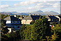
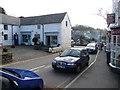
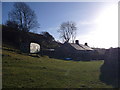
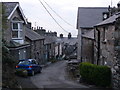
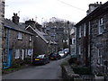
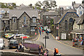
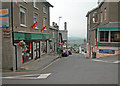
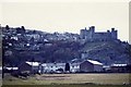
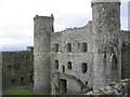
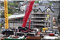
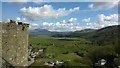
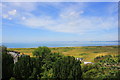
100 photos from this area
Area Information
Key information about the LL46 2YT including its size, population, and administrative classification.
- Area Type
- Postcode
- Area Size
- 34.8 hectares
- Population
- 1803
- Population Density
- 31 people/km²
House Prices in LL46 2YT
18
Properties
£255,775
Average Sold Price
£57,000
Lowest Price
£650,000
Highest Price
Showing 18 properties
| Address | Type | Beds | Baths | Last Sale Price | Last Sale Date | |
|---|---|---|---|---|---|---|
| Tŷ Crwn, High Street, Harlech, LL46 2YT | house | - | - | £415,000 | Mar 2025 | |
| Ivy House, High Street, Harlech, LL46 2YT | Detached | 2 | 1 | £104,305 | Oct 2024 | |
| Nyth Bran, High Street, Harlech, LL46 2YT | Semi-detached | 2 | - | £225,000 | May 2024 | |
| Erinfa, High Street, Harlech, LL46 2YT | house | 6 | 1 | £650,000 | Dec 2023 | |
| Bryn Twrog, High Street, Harlech, LL46 2YT | Bungalow | - | - | £450,000 | Oct 2022 | |
| Bryn Awelon, High Street, Harlech, LL46 2YT | Bungalow | - | - | £499,000 | May 2021 | |
| Tŷ Gwyn Bach, High Street, Harlech, LL46 2YT | house | - | - | £197,000 | Nov 2017 | |
| Trem Eryri, High Street, Harlech, LL46 2YT | house | - | - | £150,000 | Dec 2009 | |
| Bron Meini, High Street, Harlech, LL46 2YT | Detached | - | - | £185,000 | Apr 2009 | |
| Bwthyn Blodwen, High Street, Harlech, LL46 2YT | Semi-detached | - | - | £70,000 | Dec 2001 |
Page 1 of 2
Energy Efficiency in LL46 2YT
Amenities
Schools
| Rank | School | Type | Entry gender | Ages |
|---|
Explore more schools in this area
Go to Schools tabDemographics
Household Size
Two person
most common
Accommodation Type
Houses
most common
Tenure
76
majority
Ethnic Group
White
most common
Religion
N/A
most common
Household Composition
N/A
most common
Age
47
median
Adults (30-64 years)
most common
Household Deprivation
N/A
with no deprivation
NS-SEC
31
in Lower managerial occupations
Explore more demographic insights in this area
Go to Demographics tabPlanning
Planning Constraints
- Flood RiskPremium
- Ramsar Wetland SitesPremium
- Area of Outstanding Natural BeautyPremium
- Protected Nature ReservePremium
- Protected WoodlandPremium
- Crime RiskPremium