Area Overview for LL46 2SG
Photos of LL46 2SG
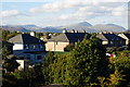
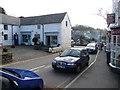
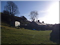
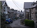
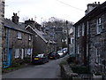
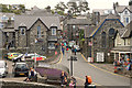
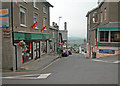
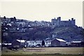
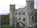
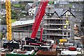
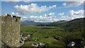
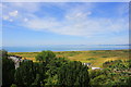
100 photos from this area
Area Information
Key information about the LL46 2SG including its size, population, and administrative classification.
- Area Type
- Postcode
- Area Size
- 4810 m²
- Population
- 1803
- Population Density
- 31 people/km²
House Prices in LL46 2SG
12
Properties
£222,350
Average Sold Price
£180,000
Lowest Price
£330,000
Highest Price
Showing 12 properties
| Address | Type | Beds | Baths | Last Sale Price | Last Sale Date | |
|---|---|---|---|---|---|---|
| Bronallt, Pen Dref, Harlech, LL46 2SG | house | 3 | 1 | £330,000 | Nov 2025 | |
| Foelas, Pen Dref, Harlech, LL46 2SG | house | - | - | £180,000 | Aug 2023 | |
| Annedd Bach, Pen Y Bryn, Harlech, LL46 2SG | house | - | - | £180,000 | Jun 2023 | |
| Fron Hyfryd, Pen Dref, Harlech, LL46 2SG | house | - | - | £202,750 | Jun 2023 | |
| Min Y Ffordd, Pen Dref, Harlech, LL46 2SG | Semi-detached | 3 | - | £219,000 | Jan 2023 | |
| Pen Y Bryn Mawr, Pen Dref, Harlech, LL46 2SG | house | - | - | - | - | |
| Pen Y Bryn Bach, Pen Dref, Harlech, LL46 2SG | Detached | - | - | - | - | |
| Bryn Tirion, Pen Y Bryn, Harlech, LL46 2SG | Detached | - | - | - | - | |
| Morlais, Pen Dref, Harlech, LL46 2SG | house | - | - | - | - | |
| Lion Hotel, Pen Dref, Harlech, LL46 2SG | restaurant_cafe | - | - | - | - |
Page 1 of 2
Energy Efficiency in LL46 2SG
Amenities
Schools
| Rank | School | Type | Entry gender | Ages |
|---|
Explore more schools in this area
Go to Schools tabDemographics
Household Size
Two person
most common
Accommodation Type
Houses
most common
Tenure
76
majority
Ethnic Group
White
most common
Religion
N/A
most common
Household Composition
N/A
most common
Age
47
median
Adults (30-64 years)
most common
Household Deprivation
N/A
with no deprivation
NS-SEC
31
in Lower managerial occupations
Explore more demographic insights in this area
Go to Demographics tabPlanning
Planning Constraints
- Flood RiskPremium
- Ramsar Wetland SitesPremium
- Area of Outstanding Natural BeautyPremium
- Protected Nature ReservePremium
- Protected WoodlandPremium
- Crime RiskPremium