Area Overview for LL44 2DN
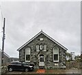
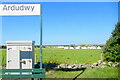
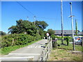
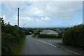
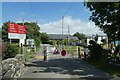
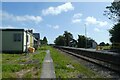
Photos of LL44 2DN
Area Information
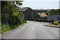
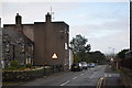
Living in LL44 2DN means being part of a small, tightly knit residential cluster in Wales, where the population of 2,380 people spreads across 2.9 hectares. The area’s low density—just 21 people per square kilometre—suggests a quiet, spacious lifestyle, with homes likely set apart from one another. This is not a sprawling suburb but a compact community, where daily life revolves around local amenities and natural surroundings. The area’s proximity to rail stations, ferry landings, and nearby schools makes it practical for families and commuters. With 77% of residents owning their homes, LL44 2DN feels more like a settled neighbourhood than a transient one. Its small size means residents likely know their neighbours, and the area’s limited footprint ensures a manageable, low-traffic environment. While it lacks the bustle of larger towns, LL44 2DN offers a simple, grounded existence, ideal for those prioritising tranquillity over urban convenience.
- Area Type
- Postcode
- Area Size
- 2.9 hectares
- Population
- 2380
- Population Density
- 21 people/km²
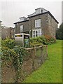
LL44 2DN’s property market is dominated by owner-occupied homes, with 77% of residents owning their properties. This contrasts with areas where rental markets dominate, suggesting a preference for long-term investment over short-term tenancy. The accommodation type is primarily houses, which aligns with the area’s low density and spacious layout. In such a small postcode, the housing stock is likely limited, with few new developments. For buyers, this means a narrow selection of properties, possibly at higher prices due to scarcity. The focus on houses over flats also implies a lifestyle prioritising private space and outdoor areas. Proximity to rail and ferry access might make the area appealing to commuters, though the small size means buyers must consider nearby towns for broader options.
House Prices in LL44 2DN
Showing 27 properties
| Address | Type | Beds | Baths | Last Sale Price | Last Sale Date | |
|---|---|---|---|---|---|---|
| Police House, Ffordd Y Neuadd, Dyffryn Ardudwy, LL44 2DN | Bungalow | - | - | £370,000 | Jun 2020 | |
| Canol Fryn, Ffordd Y Neuadd, Dyffryn Ardudwy, LL44 2DN | Detached | 4 | 1 | £251,400 | Mar 2020 | |
| Bron Eirian, Ffordd Y Neuadd, Dyffryn Ardudwy, LL44 2DN | Detached | 6 | 5 | £350,000 | Nov 2019 | |
| Awelfryn, Ffordd Capel, Dyffryn Ardudwy, LL44 2DN | Bungalow | - | - | £135,000 | Apr 2017 | |
| Arfryn, Ffordd Y Neuadd, Dyffryn Ardudwy, LL44 2DN | house | - | - | £160,000 | Dec 2016 | |
| Bryn Ysgol, Ffordd Y Neuadd, Dyffryn Ardudwy, LL44 2DN | Semi-detached | 2 | - | £141,500 | Mar 2016 | |
| Arosfa Cottage, Ffordd Capel, Dyffryn Ardudwy, LL44 2DN | Detached | 2 | 1 | £162,000 | Oct 2006 | |
| Bryn Horeb, Ffordd Capel, Dyffryn Ardudwy, LL44 2DN | Detached | - | - | £125,000 | Jul 2002 | |
| Llwyn Mafon, Ffordd Capel, Dyffryn Ardudwy, LL44 2DN | Detached | - | - | £14,000 | Dec 2001 | |
| 1, Cae Pella, Ffordd Y Neuadd, Dyffryn Ardudwy, LL44 2DN | Bungalow | 4 | 3 | - | - |
Energy Efficiency in LL44 2DN
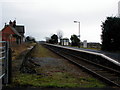
Residents of LL44 2DN have access to a range of nearby amenities, including four retail outlets like Spar and Co-op Barmouth, ensuring basic shopping needs are met. The area’s rail stations—Dyffryn Ardudwy, Talybont, and Llanbedr—offer connectivity to regional hubs, while ferry landings at Barmouth and Porth Penrhyn provide water-based travel options. Though the area is small, these facilities contribute to a self-contained lifestyle, reducing the need for long commutes. The presence of multiple rail and ferry points suggests a community that values mobility, whether for work, leisure, or socialising. While there are no named parks or leisure venues in the data, the proximity to natural areas may offer outdoor recreation opportunities. The mix of retail, transport, and water access creates a functional, if modest, lifestyle.
Amenities
Schools
Residents of LL44 2DN have access to two schools: Ysgol Gynradd Dyffryn Ardudwy and Ysgol Gynradd Llanbedr. Both are listed as ‘other’ in the data, though no Ofsted ratings are provided. The presence of two schools suggests a range of educational options, potentially catering to different needs or age groups. Families may benefit from having multiple institutions nearby, reducing travel time for children. However, without specific details on curriculum, size, or performance, it’s unclear how these schools compare to others in the region. The mix of school types—though unspecified—may offer parents choices in education, though the lack of data limits deeper analysis.
| Rank | School | Type | Entry gender | Ages |
|---|
Explore more schools in this area
Go to Schools tabDemographics
LL44 2DN’s population skews towards adults aged 30–64, with a median age of 47. This suggests a mature, stable community, likely with established careers and families. The high home ownership rate of 77% indicates long-term residency, with most properties being houses rather than flats. The predominant ethnic group is White, reflecting the area’s demographic makeup. With no data on deprivation or income levels, it’s unclear how economic factors shape daily life, but the age profile and ownership figures imply a population focused on stability and self-sufficiency. The absence of younger or older demographics might mean fewer schools catering to children or retirees, though two local schools serve the area. The community’s character is defined by its age range and housing type, creating a cohesive, low-turnover environment.
Household Size
Accommodation Type
Tenure
Ethnic Group
Religion
Household Composition
Age
Household Deprivation
NS-SEC
Explore more demographic insights in this area
Go to Demographics tabPlanning
Planning Constraints
- Flood RiskPremium
- Ramsar Wetland SitesPremium
- Area of Outstanding Natural BeautyPremium
- Protected Nature ReservePremium
- Protected WoodlandPremium
- Crime RiskPremium