Area Overview for LL43 2AX
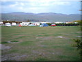
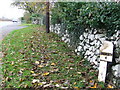
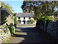
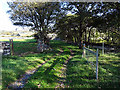
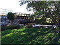
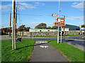
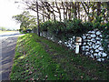
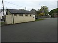
Photos of LL43 2AX


Area Information
Living in LL43 2AX offers a quiet, low-density lifestyle in a small residential cluster in Wales. With a population of 2,380 spread across 4,136 square metres, the area feels uncluttered, ideal for those seeking space without urban congestion. The community is predominantly composed of adults aged 30–64, many of whom own their homes—77% of properties are owner-occupied, reflecting a stable, settled demographic. The area’s proximity to natural landscapes and practical transport links, such as railway stations and ferry landings, ensures accessibility without sacrificing tranquillity. Nearby schools, including Ysgol Gynradd Dyffryn Ardudwy and Ysgol Gynradd Llanbedr, cater to local families, while retail options like Spar and Co-op Barmouth provide everyday convenience. LL43 2AX is suited to those prioritising a balanced, community-focused life with minimal environmental constraints.
- Area Type
- Postcode
- Area Size
- 4136 m²
- Population
- 2380
- Population Density
- 21 people/km²
LL43 2AX is primarily an owner-occupied area, with 77% of properties owned by residents rather than rented. The housing stock consists largely of houses, which is typical for a low-density, suburban postcode. This composition suggests a focus on family homes and long-term investment rather than a transient rental market. Given the small area size and limited surrounding developments, property availability is likely constrained, making it a niche market for buyers seeking a quiet, established community. The absence of planning constraints like protected woodlands or AONB designations may also simplify development processes for future homeowners.
House Prices in LL43 2AX
Showing 2 properties
| Address | Type | Beds | Baths | Last Sale Price | Last Sale Date | |
|---|---|---|---|---|---|---|
| Caravan 633, Caerelwan Caravan Park, Ffordd Glan Mor, Tal Y Bont, Barmouth, LL43 2AX | Bungalow | 3 | - | - | - | |
| Tŷ Caerelwan, Caerelwan Caravan Park, Ffordd Glan Mor, Tal Y Bont, Barmouth, LL43 2AX | office_workshop | - | - | - | - |
Energy Efficiency in LL43 2AX
Daily life in LL43 2AX is shaped by its proximity to essential amenities. Retail options include Spar and Co-op Barmouth, offering groceries and convenience services. Five railway stations, such as Talybont and Llanaber, provide regular connections to nearby towns, while Barmouth Ferry and Porth Penrhyn Ferry Landing offer access to water-based transport. The area’s low density means a slower pace, with natural landscapes likely nearby. The presence of Llanbedr Airport and metro options like Barmouth Ferry enhances mobility for residents. These amenities collectively support a lifestyle that balances convenience with a rural feel.
Amenities
Schools
Residents of LL43 2AX have access to two local schools: Ysgol Gynradd Dyffryn Ardudwy and Ysgol Gynradd Llanbedr. Both are categorised as "other" in the data, though specific Ofsted ratings are not provided. The presence of two schools within practical reach offers families options for primary education, though the types of institutions are not detailed. The mix of school types—while limited in this dataset—may reflect a blend of state and specialist provision, supporting diverse educational needs. Parents should investigate further for detailed performance metrics.
| Rank | School | Type | Entry gender | Ages |
|---|
Explore more schools in this area
Go to Schools tabDemographics
The population of LL43 2AX is 2,380, with a median age of 47 and the majority of residents falling within the 30–64 age range. This suggests a mature, established community with a strong presence of working-age adults. Home ownership is high, at 77%, indicating a preference for long-term residency over rental properties. The accommodation type is predominantly houses, aligning with the area’s low density and suburban character. The predominant ethnic group is White, reflecting the broader demographic trends in the region. While no specific data on deprivation is provided, the high home ownership and stable age profile suggest a relatively secure quality of life.
Household Size
Accommodation Type
Tenure
Ethnic Group
Religion
Household Composition
Age
Household Deprivation
NS-SEC
Explore more demographic insights in this area
Go to Demographics tabPlanning
Planning Constraints
- Flood RiskPremium
- Ramsar Wetland SitesPremium
- Area of Outstanding Natural BeautyPremium
- Protected Nature ReservePremium
- Protected WoodlandPremium
- Crime RiskPremium