Area Overview for LL42 1LH
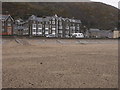
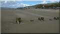
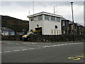
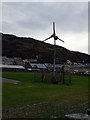
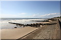
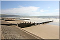
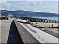
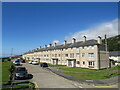
Photos of LL42 1LH


Area Information
Living in LL42 1LH means being part of a small, closely knit residential cluster in Wales, where the population of 2,146 people spreads across a low-density area of 133 people per square kilometre. This postcode covers a quiet, settled community, typical of rural Welsh settings, with homes predominantly in private ownership. Daily life here is shaped by proximity to natural landscapes and local amenities, though the area’s compact size means most activities are within walking or short driving distance. The presence of multiple railway stations and ferry landings suggests a reliance on public transport for commuting or leisure. While the area lacks large-scale infrastructure, its small size fosters a sense of familiarity among residents. The median age of 47 indicates a mature population, with many households likely established for decades. For those seeking a tranquil, low-traffic environment with access to coastal or rural features, LL42 1LH offers a distinct contrast to urban centres, though its limited retail and service options may require trips to nearby towns.
- Area Type
- Postcode
- Area Size
- Not available
- Population
- 2146
- Population Density
- 133 people/km²
The property market in LL42 1LH is characterised by a 57% home ownership rate, with houses making up the majority of accommodation types. This suggests a market skewed towards owner-occupied homes rather than rentals, though the exact number of rental properties is not specified. The small population and low density mean the housing stock is likely limited to individual family homes, with little scope for high-density development. For buyers, this implies a focus on standalone properties rather than apartments or shared housing. The area’s compact size means property values may be influenced more by proximity to amenities like rail and ferry services than by broader market trends. Given the lack of major planning constraints, such as protected woodlands or AONBs, development restrictions are minimal, though the small population may limit demand. Buyers should consider the area’s limited retail and service infrastructure when assessing long-term viability, as reliance on nearby towns for shopping and leisure is likely.
House Prices in LL42 1LH
No properties found in this postcode.
Energy Efficiency in LL42 1LH
Residents of LL42 1LH have access to four retail outlets, including Co-op Barmouth, Iceland Barmouth, and Spar, providing basic grocery and convenience shopping. The area’s rail network, with five stations, and ferry services at Barmouth and Porth Penrhyn, suggest opportunities for commuting or day trips. The presence of a metro service, Barmouth Ferry, adds to the transport options, though its exact route or frequency is unspecified. While the data does not list parks or leisure facilities directly, the absence of environmental constraints like protected woodlands or AONBs implies open spaces may be available for recreation. The mix of retail, rail, and ferry services indicates a lifestyle focused on practicality and connectivity to nearby towns, with limited on-site amenities. For those prioritising convenience, the area’s small size means most needs can be met locally, though larger-scale entertainment or dining options would require travel.
Amenities
Schools
The nearest school to LL42 1LH is Ysgol y Traeth, which is categorised as an "other" type in the data, though no Ofsted rating or specific educational level is provided. This suggests the school may serve a local community with mixed age ranges or specialisms, but without further details, its exact role is unclear. The absence of primary or secondary schools listed means families may need to travel to nearby towns for schooling, which could impact decisions about settling in the area. The single listed school highlights a potential limitation for parents prioritising proximity to education, though the area’s low population density may mean the school serves a broader regional catchment. For those considering LL42 1LH, it is advisable to investigate additional educational options beyond the immediate postcode, as the data does not confirm the school’s capacity or academic performance.
| Rank | School | Type | Entry gender | Ages |
|---|
Explore more schools in this area
Go to Schools tabDemographics
The community in LL42 1LH is predominantly composed of adults aged 30–64, with a median age of 47, suggesting a population largely in their prime working and family-raising years. Home ownership stands at 57%, indicating a mix of owner-occupied properties and rental units, though the exact proportion of renters is not specified. The area’s accommodation type is primarily houses, which aligns with the lower population density and the typical layout of rural Welsh settlements. The predominant ethnic group is White, though no further breakdown of diversity is provided in the data. The absence of detailed deprivation metrics means it is unclear how economic factors might influence quality of life, but the low flood risk and lack of environmental constraints suggest a stable living environment. The age profile and housing stock imply a community focused on long-term residency rather than transient populations, with fewer young families or elderly residents compared to other areas.
Household Size
Accommodation Type
Tenure
Ethnic Group
Religion
Household Composition
Age
Household Deprivation
NS-SEC
Explore more demographic insights in this area
Go to Demographics tabPlanning
Planning Constraints
- Flood RiskPremium
- Ramsar Wetland SitesPremium
- Area of Outstanding Natural BeautyPremium
- Protected Nature ReservePremium
- Protected WoodlandPremium
- Crime RiskPremium